| Filename | Brittain_MAPH_60_2018-08-02_1 |
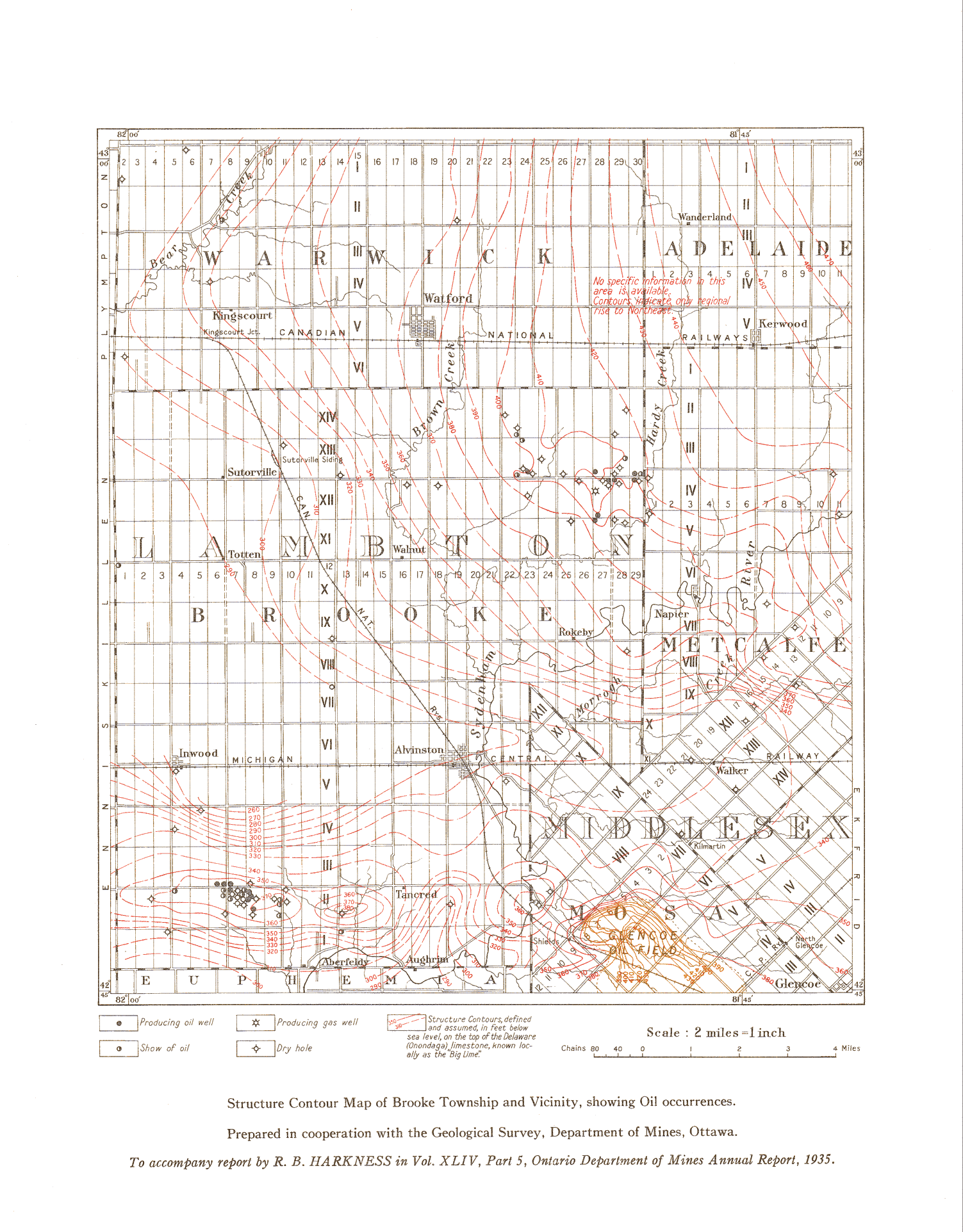
| Map Title | Structure Contour Map of Brooke Township and Vicinity |
| Front/Back | Front |
| Blank | No |
| Physical Location | MAPH |
| Cartographer | Geological Survey of Canada |
| Publisher | Department of Mines |
| Date | 1935-01-01 |
| Copyright Holder | Government |
| Map Type | Resource |
| Continent | North America |
| Country | Canada |
| State | Ontario |
| County | |
| Township | Brooke |
| Municipality | |
| Lat Ne | 43.004654 |
| Long Ne | -81.705964 |
| Lat Sw | 42.756617 |
| Long Sw | -82.004277 |
| Map Scale Text | 1 inch: 2 miles |
| Map Scale Ratio | 1:126,720 |
| Quality Score | 2 |
| Documentation Score | 2 |
| Georeference Algorithm | |
| Well Points | Yes |
| Notes | A map showing structure contours and oil occurrences in Brooke township, showing Warwick, Adelaide, Metcalfe, and Mosa. |