| Filename | Brittain_MAPH_396_2018-08-01_1 |
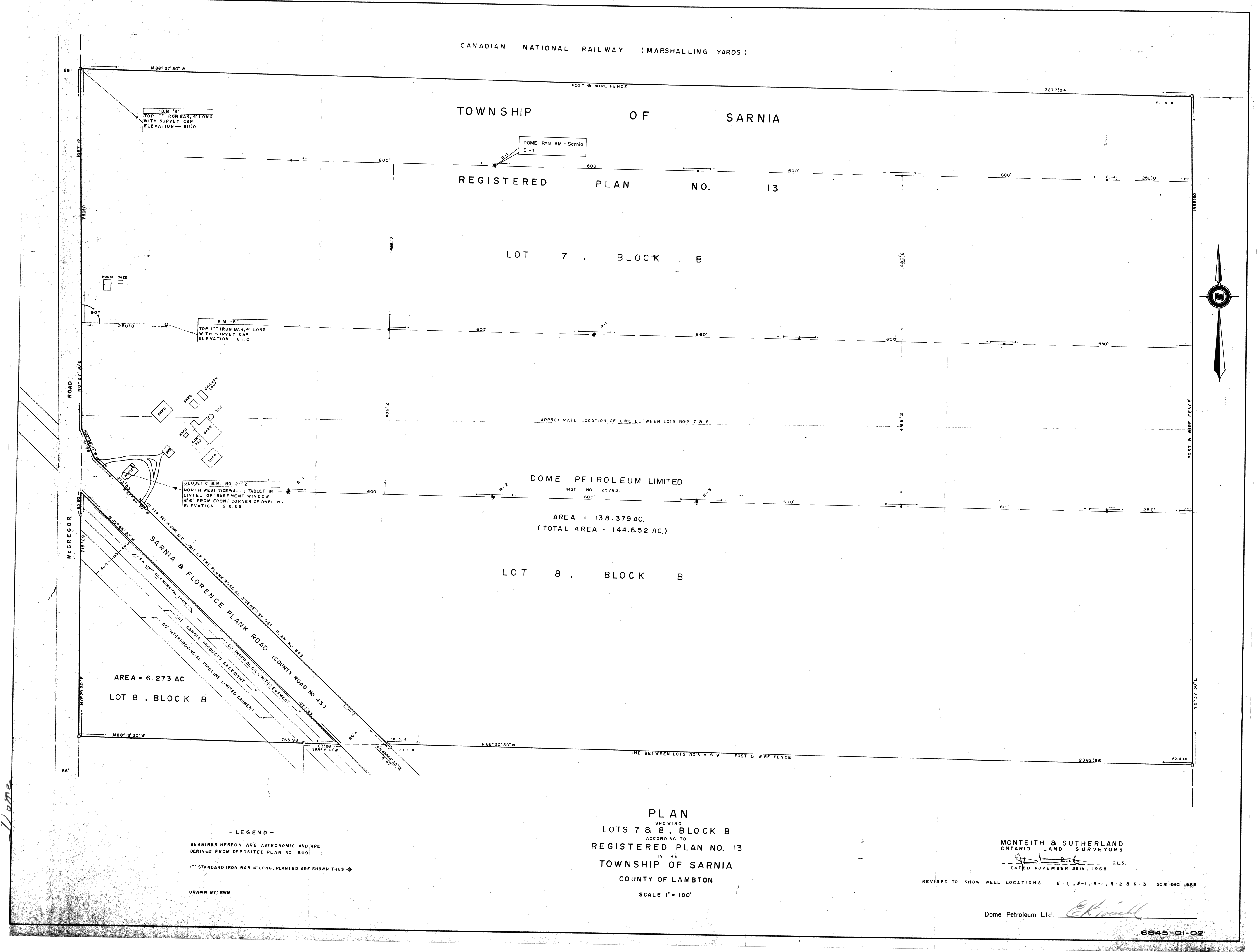
| Map Title | Plan Showing Lots 7 & 8, Block B According to Registered Plan No. 13 in the Township of Sarnia |
| Front/Back | Front |
| Blank | No |
| Physical Location | MAPH |
| Cartographer | R. W. M. |
| Publisher | Monteith & Sutherland Limited, Ontario Land Surveyors |
| Date | 1968-11-26 |
| Copyright Holder | Private |
| Map Type | Resource |
| Continent | North America |
| Country | Canada |
| State | Ontario |
| County | Lambton |
| Township | Sarnia |
| Municipality | |
| Lat Ne | 42.960002 |
| Long Ne | -82.356182 |
| Lat Sw | 42.947596 |
| Long Sw | -82.368698 |
| Map Scale Text | 1 inch: 100 feet |
| Map Scale Ratio | 1:1,200 |
| Quality Score | 2 |
| Documentation Score | 3 |
| Georeference Algorithm | |
| Well Points | Yes |
| Notes | A map of lots 7 & 8 in the Sarnia Township showing iron bars and bearings. |