| Filename | Brittain_MAPH_24_2018-08-01_1 |
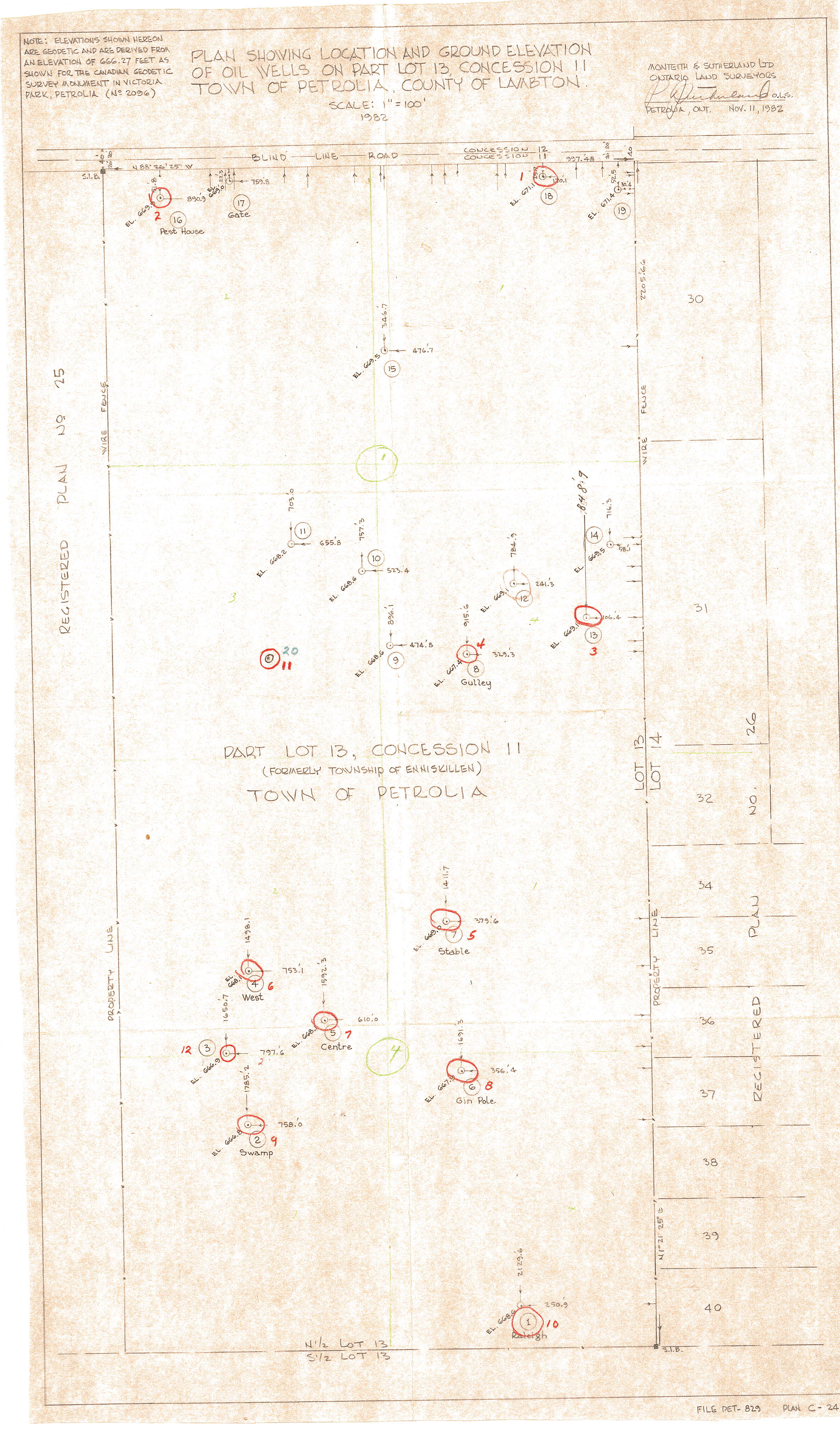
| Map Title | Plan Showing Location and Ground Elevation of Oil Wells (Part Lot 13 Concession II, Town of Petrolia) |
| Front/Back | Front |
| Blank | No |
| Physical Location | MAPH |
| Cartographer | Monteith & Sutherland Limited - Ontario Land Surveyors |
| Publisher | Monteith & Sutherland Limited, Ontario Land Surveyors |
| Date | 1982-11-11 |
| Copyright Holder | Private |
| Map Type | Resource |
| Continent | North America |
| Country | Canada |
| State | Ontario |
| County | Lambton |
| Township | |
| Municipality | |
| Lat Ne | 42.894067 |
| Long Ne | -82.134326 |
| Lat Sw | 42.890094 |
| Long Sw | -82.138564 |
| Map Scale Text | 1 inch: 100 feet |
| Map Scale Ratio | 1:1,200 |
| Quality Score | 2 |
| Documentation Score | 3 |
| Georeference Algorithm | |
| Well Points | Yes |
| Notes | A land plan of Lot 13, Concession II in the Town of Petrolia showing well points. |