| Filename | Brittain_MAPH_25_2018-08-01_1 |
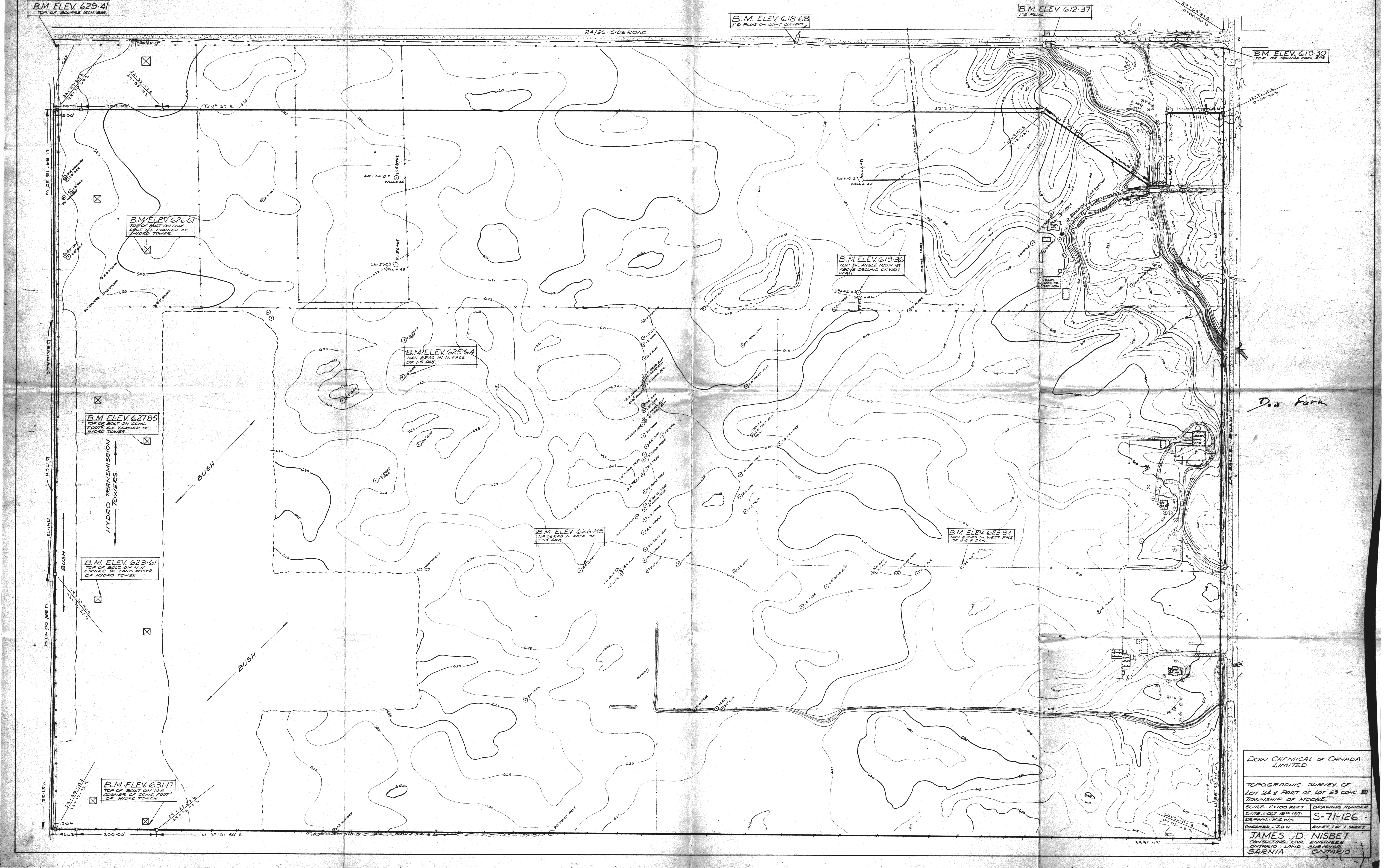
| Map Title | Topographic Survey of Lot 24/Lot 23, Con XII, Township of Moore (S-71-126) |
| Front/Back | Front |
| Blank | No |
| Physical Location | MAPH |
| Cartographer | N. G. W. |
| Publisher | Dow Chemical of Canada Limited |
| Date | 1971-10-19 |
| Copyright Holder | Private |
| Map Type | Resource |
| Continent | North America |
| Country | Canada |
| State | Ontario |
| County | |
| Township | Moore |
| Municipality | |
| Lat Ne | 42.911977 |
| Long Ne | -82.398747 |
| Lat Sw | 42.900024 |
| Long Sw | -82.413362 |
| Map Scale Text | 1 inch: 100 feet |
| Map Scale Ratio | 1:1,200 |
| Quality Score | 2 |
| Documentation Score | 2 |
| Georeference Algorithm | |
| Well Points | No |
| Notes | A land plan of Lot 24 and part of Lot 23 Concession 12 in Moore Township showing contours. |