| Filename | Brittain_MAPH_183_2018-08-07_1 |
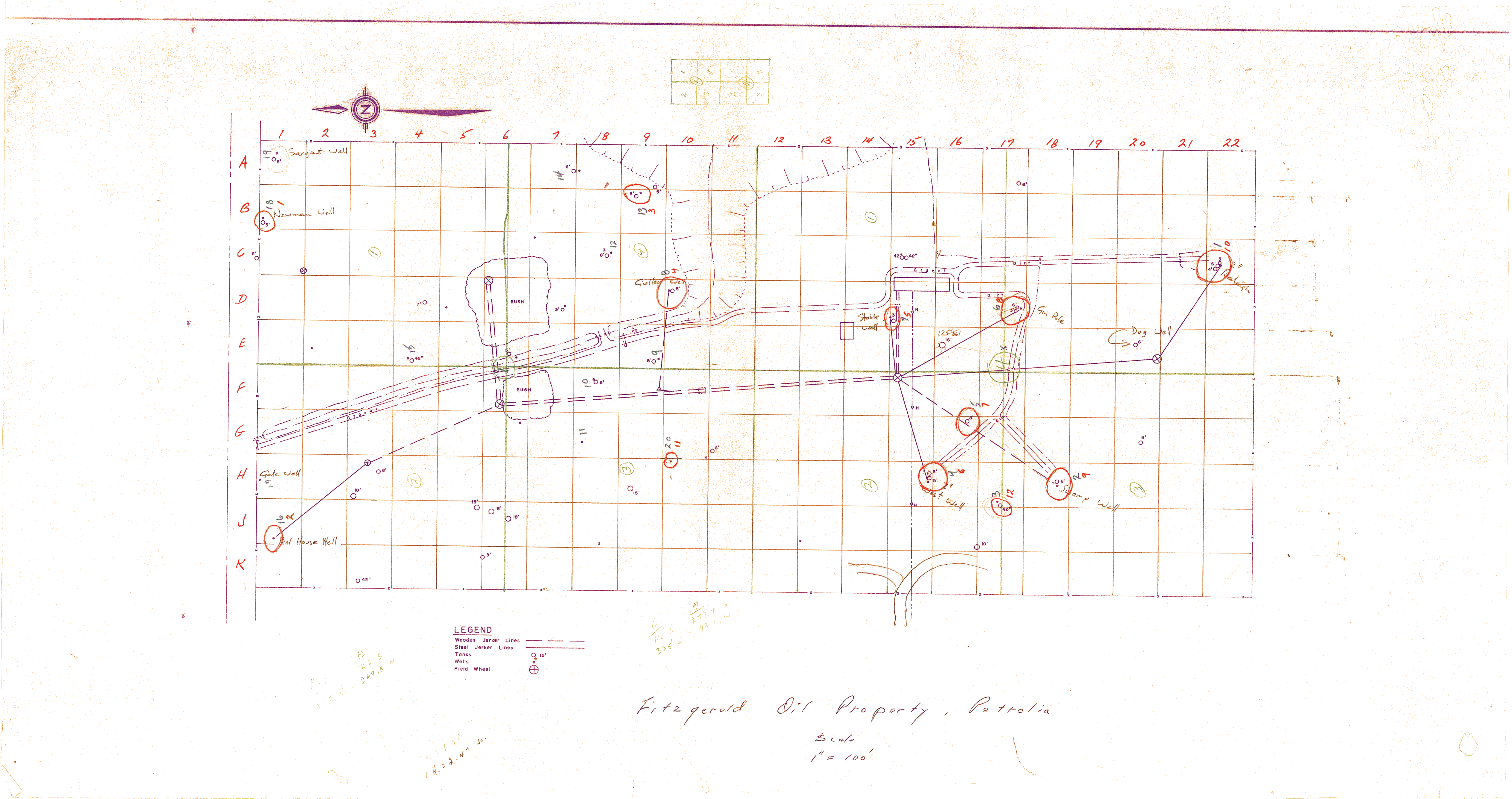
| Map Title | Fitzgerald Oil Property, Petrolia |
| Front/Back | Front |
| Blank | No |
| Physical Location | MAPH |
| Cartographer | |
| Publisher | |
| Date | |
| Copyright Holder | |
| Map Type | Resource |
| Continent | North America |
| Country | Canada |
| State | Ontario |
| County | |
| Township | |
| Municipality | |
| Lat Ne | 42.894148 |
| Long Ne | -82.143853 |
| Lat Sw | 42.892696 |
| Long Sw | -82.146089 |
| Map Scale Text | 1 inch: 100 feet |
| Map Scale Ratio | 1:1,200 |
| Quality Score | 2 |
| Documentation Score | 2 |
| Georeference Algorithm | |
| Well Points | Yes |
| Notes | A hand drawn map showing pipelines, well locations, and jerker lines. |