| Filename | Brittain_MAPH_184_2018-08-07_1 |
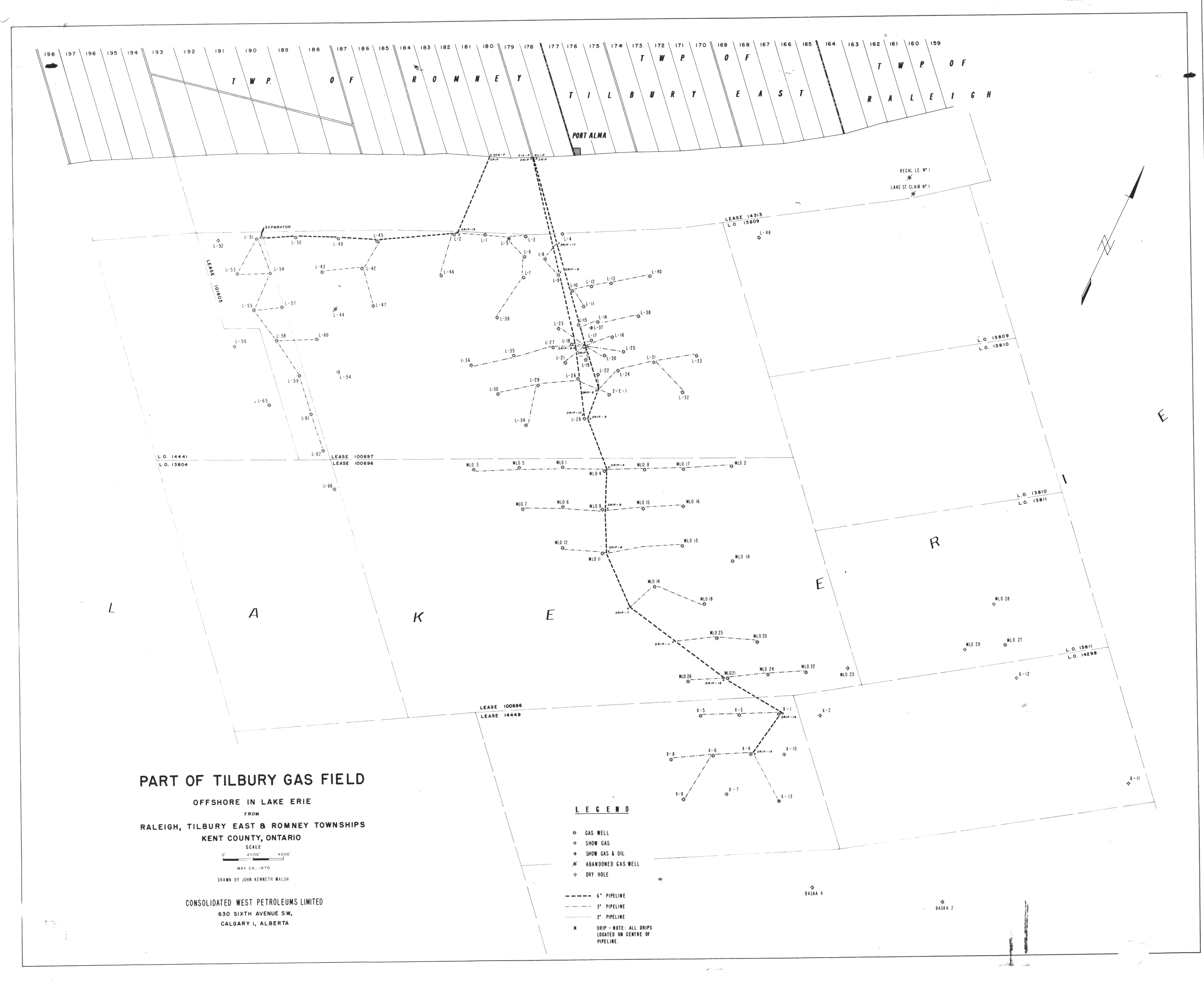
| Map Title | Part of Tilbury Gas Field Offshore in Lake Erie From Raleigh, Tilbury East & Romney Townships |
| Front/Back | Front |
| Blank | No |
| Physical Location | MAPH |
| Cartographer | John Kenneth Walsh |
| Publisher | Consolidated West Petroleums Limited |
| Date | 1970-05-29 |
| Copyright Holder | Private |
| Map Type | Resource |
| Continent | North America |
| Country | Canada |
| State | Ontario |
| County | Kent |
| Township | |
| Municipality | |
| Lat Ne | 42.225525 |
| Long Ne | -82.172898 |
| Lat Sw | 42.099952 |
| Long Sw | -82.311418 |
| Map Scale Text | 1 inch: 2000 feet |
| Map Scale Ratio | 1:24,000 |
| Quality Score | 2 |
| Documentation Score | 2 |
| Georeference Algorithm | |
| Well Points | Yes |
| Notes | Map of Raleigh, Tilbury East, and Romney Townships showing well locations and pipeline. |