| Filename | Brittain_MAPH_158_2018-08-07_1 |
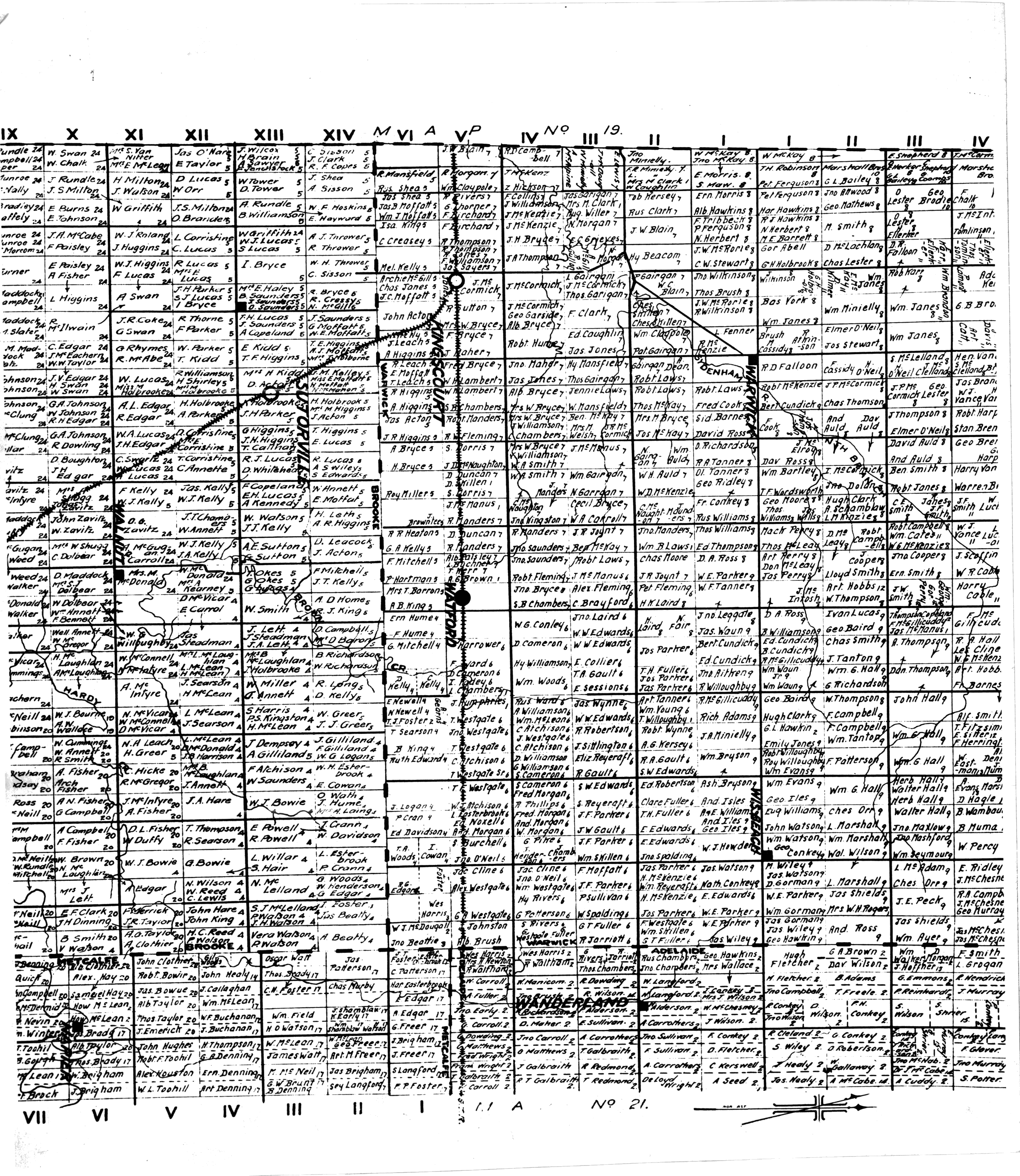
| Map Title | Brooke-Warwick-Metcalfe Landowners |
| Front/Back | Front |
| Blank | No |
| Physical Location | MAPH |
| Cartographer | |
| Publisher | |
| Date | |
| Copyright Holder | Private |
| Map Type | Thematic |
| Continent | North America |
| Country | Canada |
| State | Ontario |
| County | Lambton |
| Township | |
| Municipality | |
| Lat Ne | 43.051547 |
| Long Ne | -82.001249 |
| Lat Sw | 42.849249 |
| Long Sw | -81.7441 |
| Map Scale Text | |
| Map Scale Ratio | |
| Quality Score | 2 |
| Documentation Score | 2 |
| Georeference Algorithm | |
| Well Points | No |
| Notes | A map of landowners in Brooke-Warwick-Metcalfe areas by lots and concessions. |