| Filename | Brittain_MAPFC_219_2018-08-07_1 |
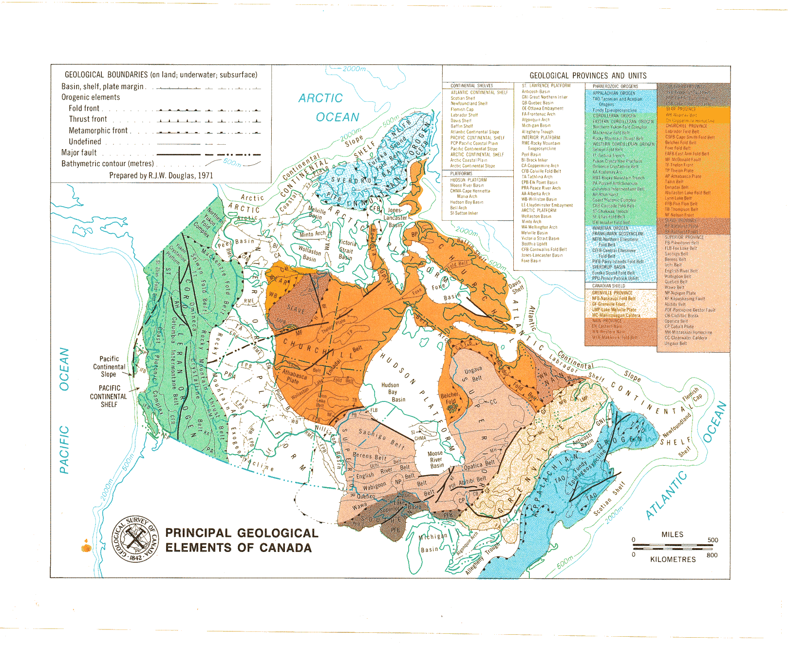
| Map Title | Principal Geological Elements of Canada |
| Front/Back | Front |
| Blank | No |
| Physical Location | MAPFC |
| Cartographer | R.J.W Douglas |
| Publisher | Geological Survey of Canada |
| Date | 1971-01-01 |
| Copyright Holder | Government |
| Map Type | Thematic |
| Continent | North America |
| Country | Canada |
| State | |
| County | |
| Township | |
| Municipality | |
| Lat Ne | 64.870524 |
| Long Ne | -17.686986 |
| Lat Sw | 37.349596 |
| Long Sw | -129.340047 |
| Map Scale Text | 1 inch: 500 miles |
| Map Scale Ratio | 1:31,680,000 |
| Quality Score | 2 |
| Documentation Score | 1 |
| Georeference Algorithm | |
| Well Points | No |
| Notes | A map of Canada showing geological boundaries and fault lines. |