| Filename | Brittain_MAPFC_218_2018-08-07_1 |
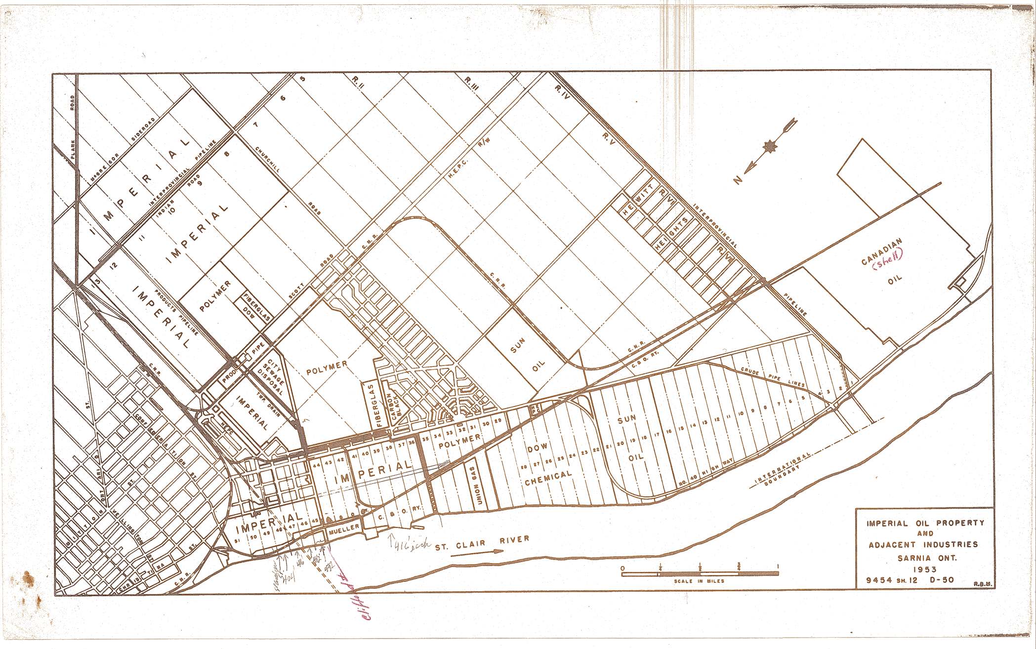
| Map Title | Imperial Oil Property and Adjacent Industries |
| Front/Back | Front |
| Blank | No |
| Physical Location | MAPFC |
| Cartographer | Imperial Oil |
| Publisher | Imperial Oil |
| Date | 1953-01-01 |
| Copyright Holder | Private |
| Map Type | Political |
| Continent | North America |
| Country | Canada |
| State | Ontario |
| County | |
| Township | |
| Municipality | |
| Lat Ne | 42.886966 |
| Long Ne | -82.44091 |
| Lat Sw | 42.969678 |
| Long Sw | -82.41378 |
| Map Scale Text | 1 inch: 1/4 mile |
| Map Scale Ratio | 1:15,840 |
| Quality Score | 2 |
| Documentation Score | 1 |
| Georeference Algorithm | |
| Well Points | No |
| Notes | An Imperial Oil Property map in relation to the St. Clair River. |