| Filename | Brittain_MAPH_70_2018-08-02_1 |
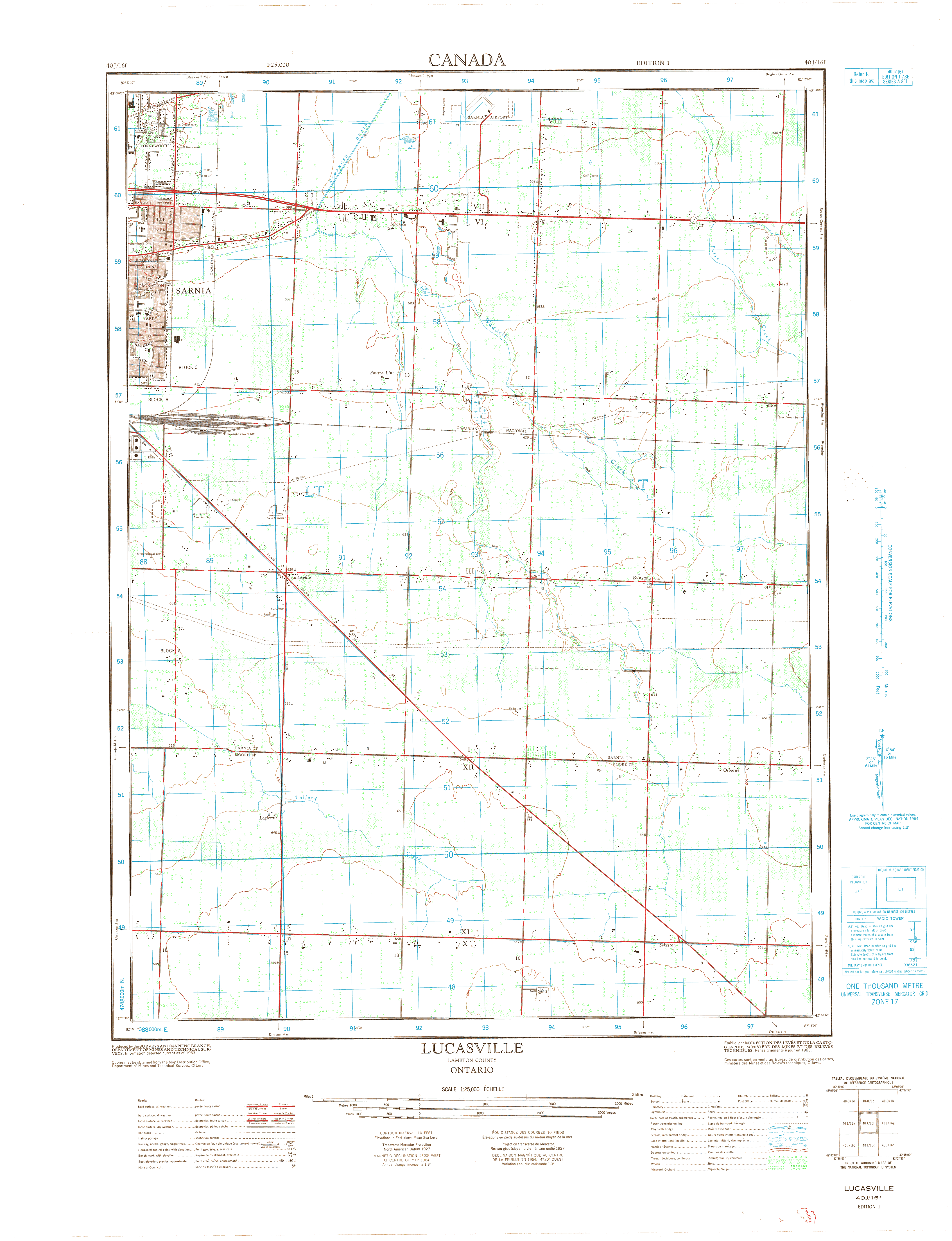
| Map Title | Lucasville - Lambton County |
| Front/Back | Front |
| Blank | No |
| Physical Location | MAPH |
| Cartographer | Department of Mines and Technical Surveys |
| Publisher | Department of Mines and Technical Surveys |
| Date | 1963-01-01 |
| Copyright Holder | Government |
| Map Type | Physical |
| Continent | North America |
| Country | Canada |
| State | Ontario |
| County | Lambton |
| Township | |
| Municipality | |
| Lat Ne | 42.999152 |
| Long Ne | -82.230595 |
| Lat Sw | 42.795568 |
| Long Sw | -82.357831 |
| Map Scale Text | |
| Map Scale Ratio | 1: 25,000 |
| Quality Score | 2 |
| Documentation Score | 1 |
| Georeference Algorithm | |
| Well Points | No |
| Notes | A map showing Lucasville, Lambton County, Ontario. |