| Filename | Brittain_MAPH_63_2018-08-02_1 |
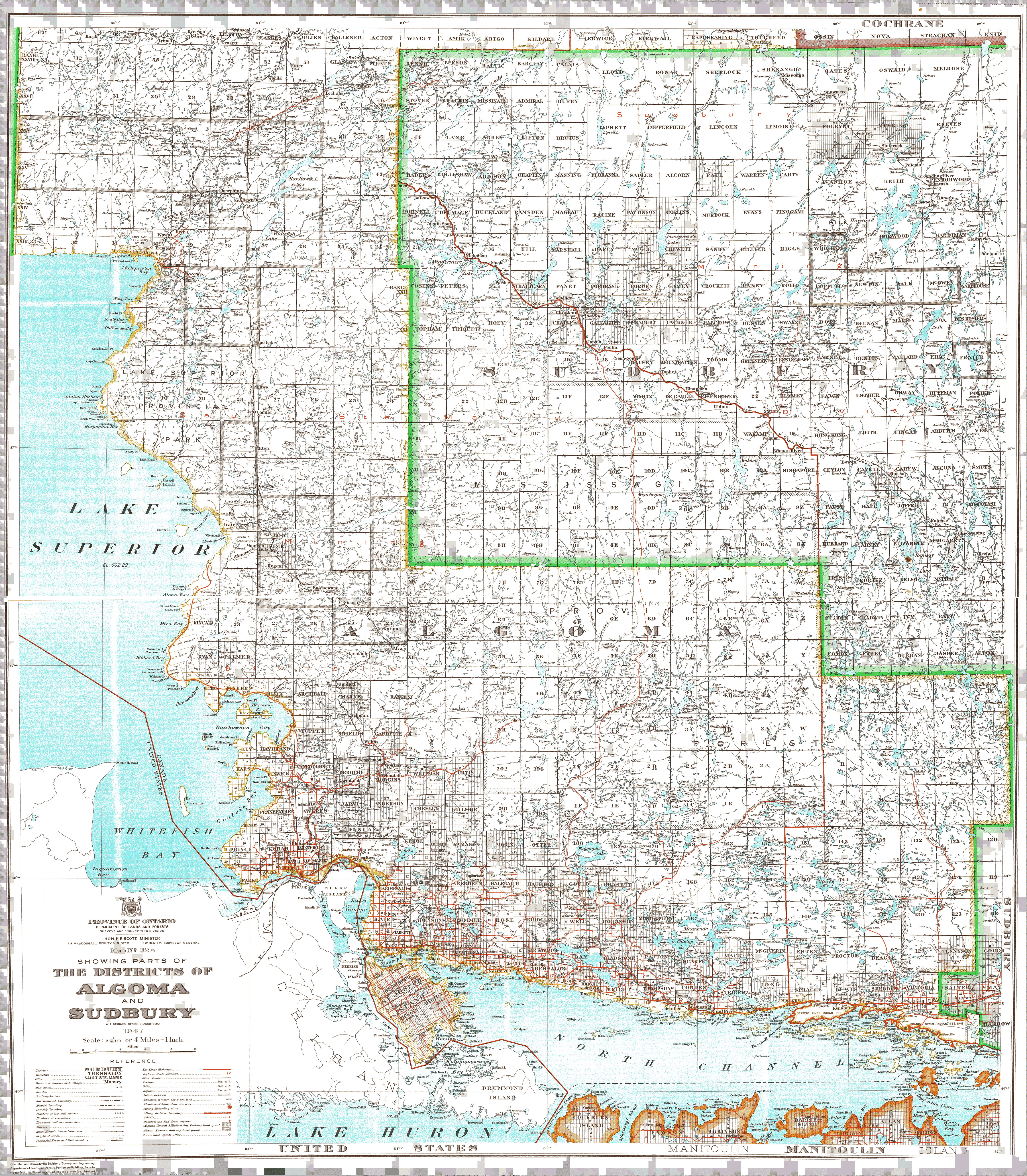
| Map Title | Districts of Algoma and Sudbury |
| Front/Back | Front |
| Blank | No |
| Physical Location | MAPH |
| Cartographer | W. A. Barnard |
| Publisher | Department of Lands and Forests |
| Date | 1947-01-01 |
| Copyright Holder | Government |
| Map Type | Thematic |
| Continent | North America |
| Country | Canada |
| State | Ontario |
| County | |
| Township | |
| Municipality | |
| Lat Ne | 48.449815 |
| Long Ne | -81.849054 |
| Lat Sw | 45.981132 |
| Long Sw | -85.272456 |
| Map Scale Text | 1 inch: 4 miles |
| Map Scale Ratio | 1:253,440 |
| Quality Score | 2 |
| Documentation Score | 1 |
| Georeference Algorithm | |
| Well Points | No |
| Notes | A map showing the districts of Algoma and Sudbury with lots and concessions. |