| Filename | Brittain_MAPH_59_2018-08-02_1 |
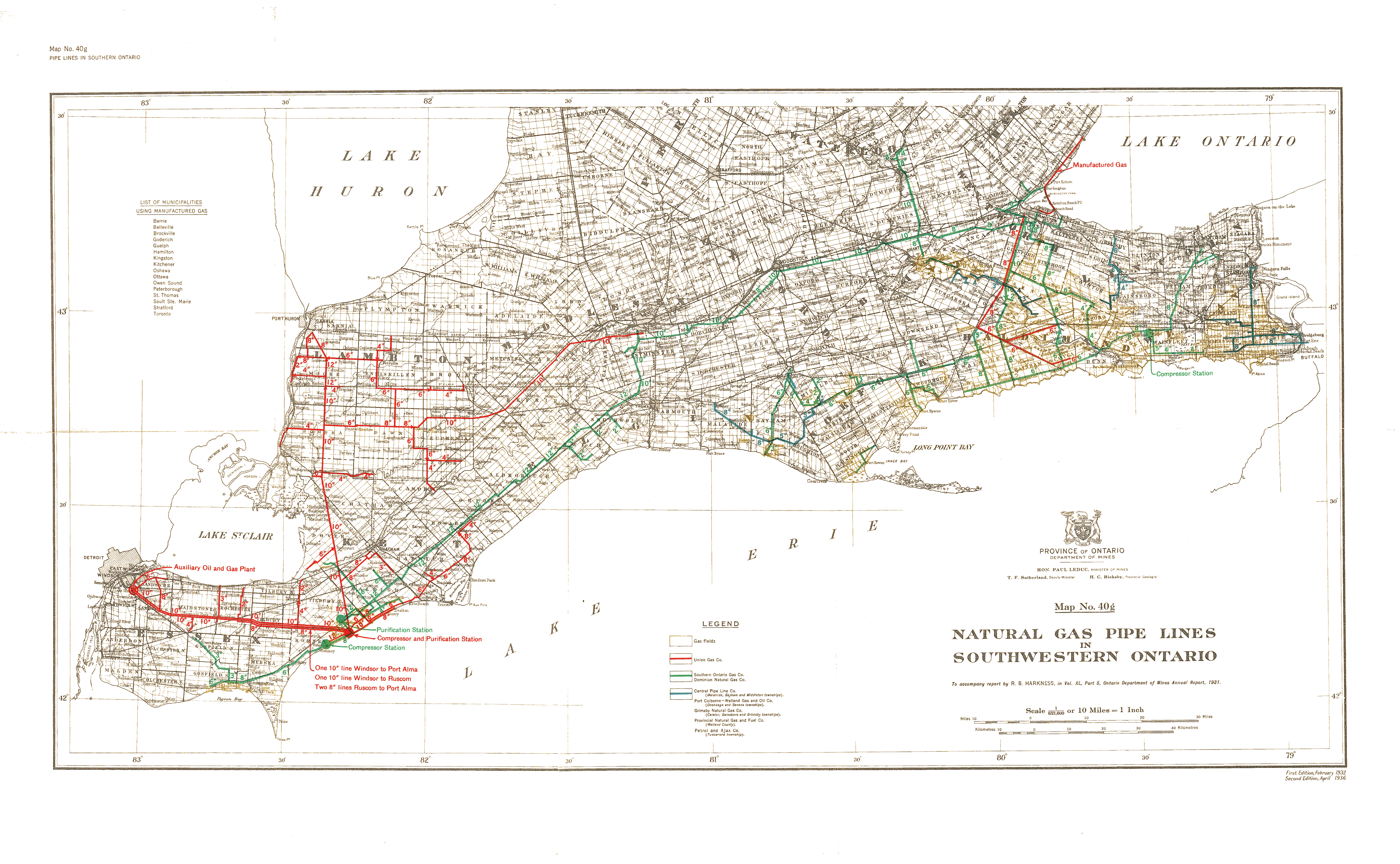
| Map Title | Natural Gas Pipe Lines in Southwestern Ontario |
| Front/Back | Front |
| Blank | No |
| Physical Location | MAPH |
| Cartographer | Natural Gas Commissioners Office |
| Publisher | Province of Ontario Department of Mines |
| Date | 1936-04-01 |
| Copyright Holder | Government |
| Map Type | Resource |
| Continent | North America |
| Country | Canada |
| State | Ontario |
| County | |
| Township | |
| Municipality | |
| Lat Ne | 43.460197 |
| Long Ne | -78.724017 |
| Lat Sw | 41.879116 |
| Long Sw | -83.191162 |
| Map Scale Text | 1 inch: 10 miles |
| Map Scale Ratio | 1:633,600 |
| Quality Score | 2 |
| Documentation Score | 2 |
| Georeference Algorithm | |
| Well Points | No |
| Notes | A map showing southwestern Ontario gas fields and pipelines from the following companies: Union Gas Company, Southern Ontario Gas Company, Dominion Natural Gas Company, Central Pipeline Company, Port Colborne-Welland Gas and Oil Company, Grimsby Natural Gas Company, Provincial Natural Gas and Fuel Company, and Petrol and Ajax Company. |