| Filename | Brittain_MAPH_38_2018-08-01_1 |
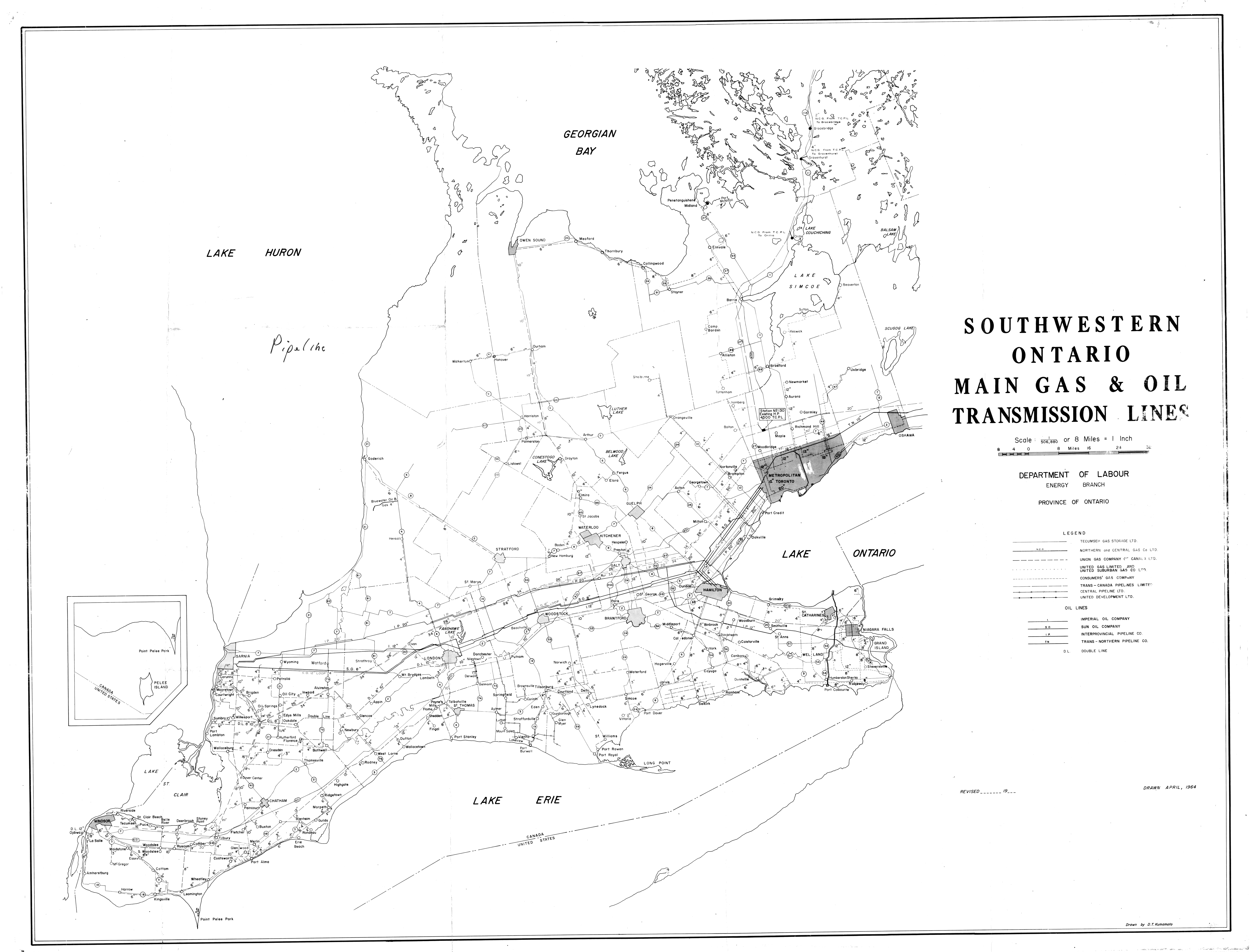
| Map Title | Southwestern Ontario Main Gas and Oil Transmission Lines |
| Front/Back | Front |
| Blank | No |
| Physical Location | MAPH |
| Cartographer | D. T. Kumamoto |
| Publisher | Department of Labour, Energy Branch |
| Date | 1964-04-01 |
| Copyright Holder | Government |
| Map Type | Resource |
| Continent | North America |
| Country | Canada |
| State | Ontario |
| County | |
| Township | |
| Municipality | |
| Lat Ne | 45.370351 |
| Long Ne | -78.480663 |
| Lat Sw | 41.87823 |
| Long Sw | -83.246391 |
| Map Scale Text | 1 inch: 8 miles |
| Map Scale Ratio | 1:506,880 |
| Quality Score | 2 |
| Documentation Score | 2 |
| Georeference Algorithm | |
| Well Points | No |
| Notes | A map of transmission lines across Southwestern Ontario. |