| Filename | Brittain_MAPH_28_2018-08-01_1 |
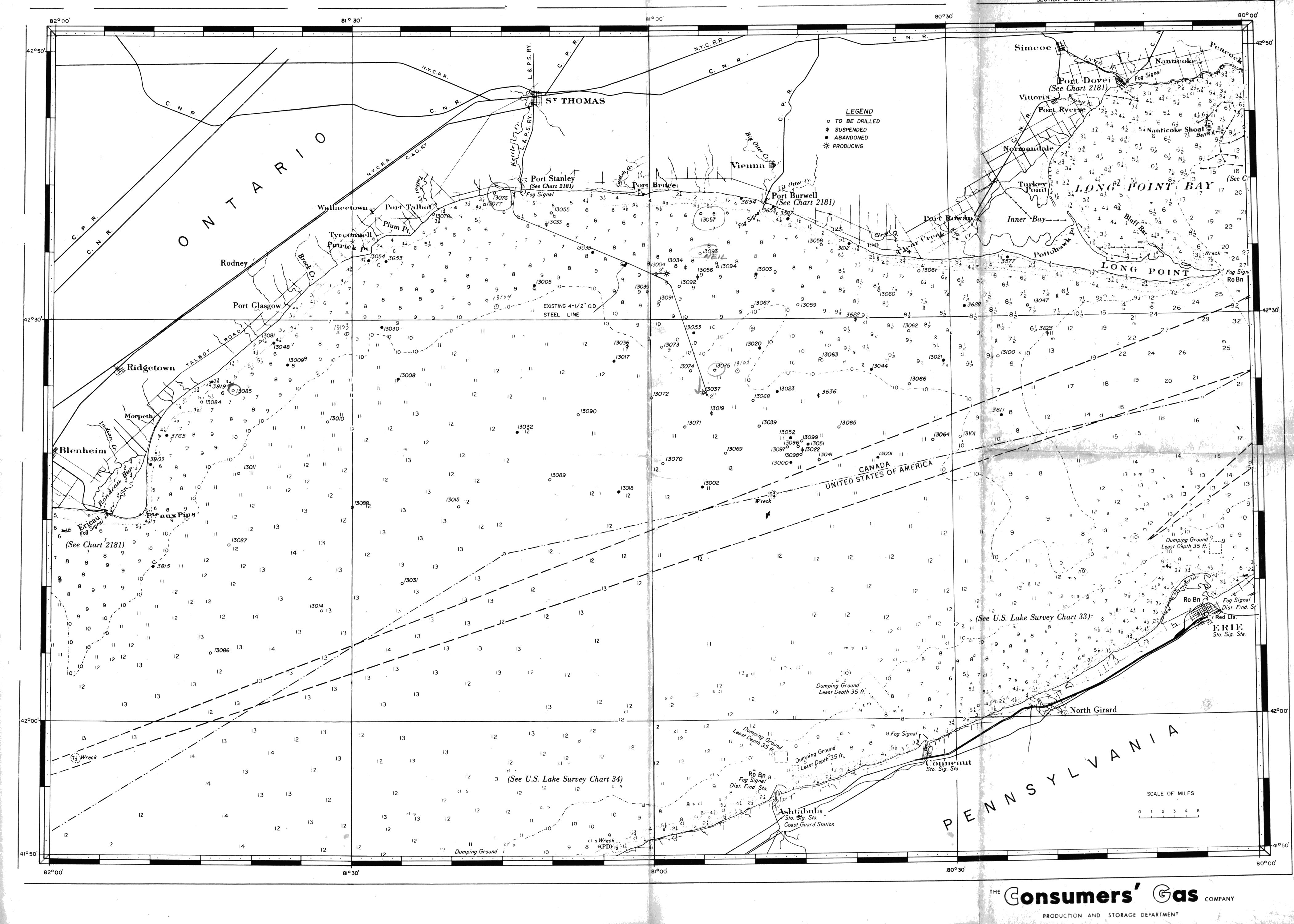
| Map Title | Lake Erie Well Points - Consumer\'s Gas Company |
| Front/Back | Front |
| Blank | No |
| Physical Location | MAPH |
| Cartographer | |
| Publisher | Consumer\'s Gas Company |
| Date | |
| Copyright Holder | Private |
| Map Type | Resource |
| Continent | North America |
| Country | Canada |
| State | Ontario |
| County | |
| Township | |
| Municipality | |
| Lat Ne | 42.791797 |
| Long Ne | -79.900649 |
| Lat Sw | 41.702433 |
| Long Sw | -82.013108 |
| Map Scale Text | 1:250,000 |
| Map Scale Ratio | 1:250,000 |
| Quality Score | 2 |
| Documentation Score | 2 |
| Georeference Algorithm | |
| Well Points | Yes |
| Notes | A map of Lake Erie showing well points to be drilled, suspended, abandoned, and producing. |