| Filename | Brittain_MAPH_27_2018-08-01_1 |
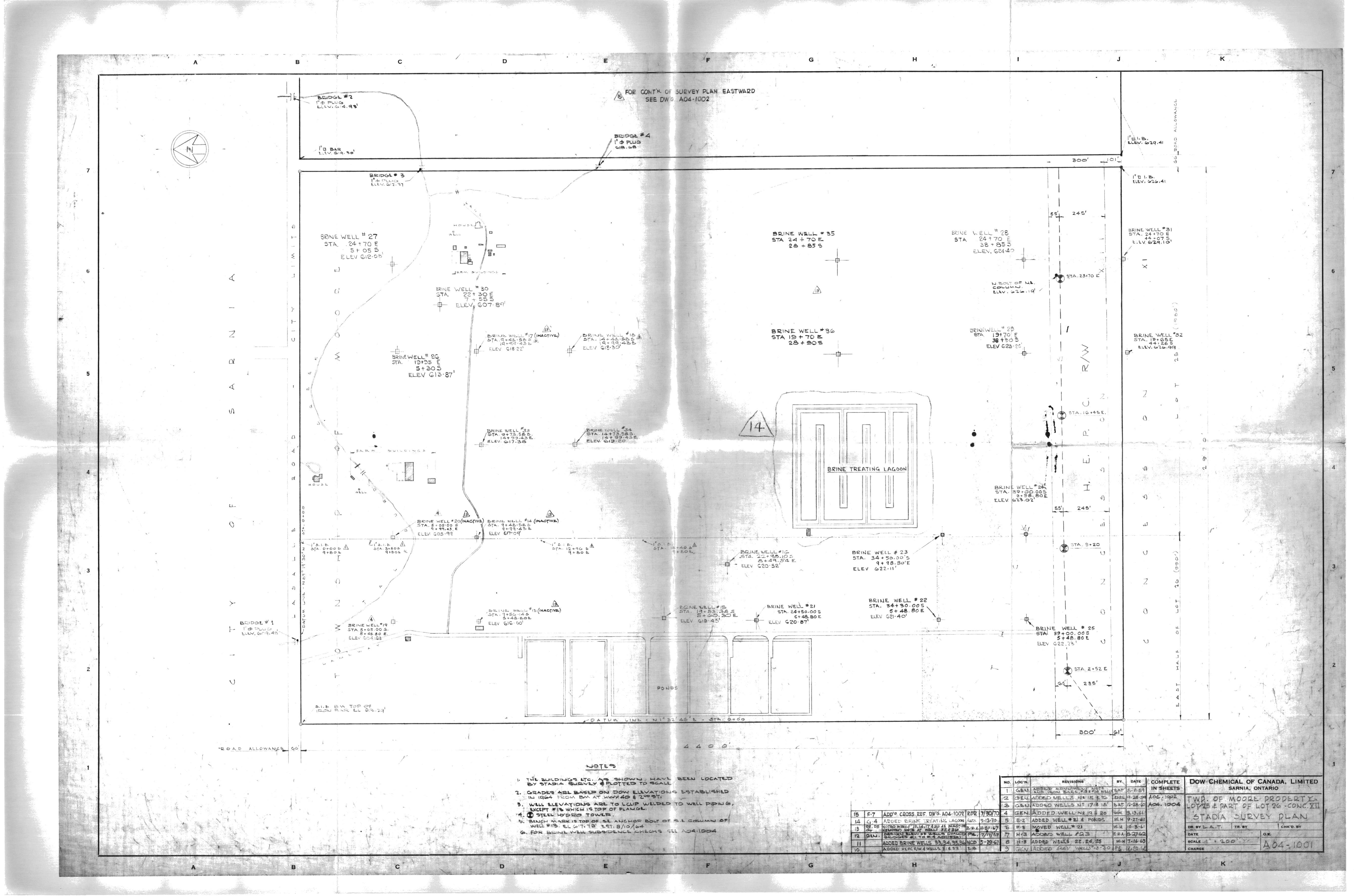
| Map Title | Township of Moore Property Lot 25/26, Con XII Stadia Survey Plan (A04-1001) |
| Front/Back | Front |
| Blank | No |
| Physical Location | MAPH |
| Cartographer | L. A. T. |
| Publisher | Dow Chemical of Canada Limited |
| Date | |
| Copyright Holder | Private |
| Map Type | Resource |
| Continent | North America |
| Country | Canada |
| State | Ontario |
| County | |
| Township | Moore |
| Municipality | |
| Lat Ne | 42.912231 |
| Long Ne | -82.413091 |
| Lat Sw | 42.900248 |
| Long Sw | -82.429128 |
| Map Scale Text | 1 inch: 200 feet |
| Map Scale Ratio | 1:2,400 |
| Quality Score | 2 |
| Documentation Score | 2 |
| Georeference Algorithm | |
| Well Points | Yes |
| Notes | A land plan of Lot 25 and part of Lot 24 Concession 12 in Moore Township showing brine wells and locations with edits and notes. |