| Filename | Brittain_MAPH_165_2018-08-07_1 |
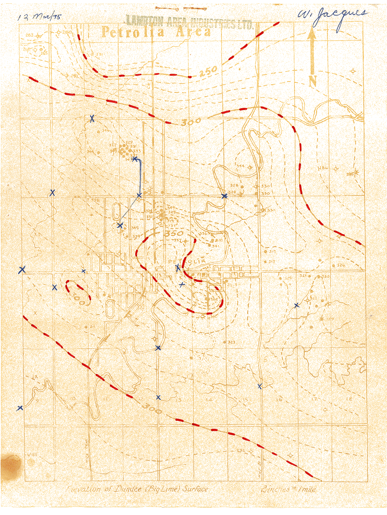
| Map Title | Elevation of Dundee (Big Lime) Surface - Petrolia Area |
| Front/Back | Front |
| Blank | No |
| Physical Location | MAPH |
| Cartographer | Lambton Area Industries Limited. |
| Publisher | Lambton Area Industries Limited |
| Date | 1995-03-13 |
| Copyright Holder | Private |
| Map Type | Resource |
| Continent | North America |
| Country | Canada |
| State | Ontario |
| County | |
| Township | |
| Municipality | |
| Lat Ne | 42.918183 |
| Long Ne | -82.076547 |
| Lat Sw | 42.833253 |
| Long Sw | -82.18212 |
| Map Scale Text | 2 inches: 1 mile |
| Map Scale Ratio | 1:31,680 |
| Quality Score | 2 |
| Documentation Score | 2 |
| Georeference Algorithm | |
| Well Points | Yes |
| Notes | A map of the Petrolia area with well points and contours showing the Dundee Surface. |