| Filename | Brittain_MAPFC_453_2018-07-23_1 |
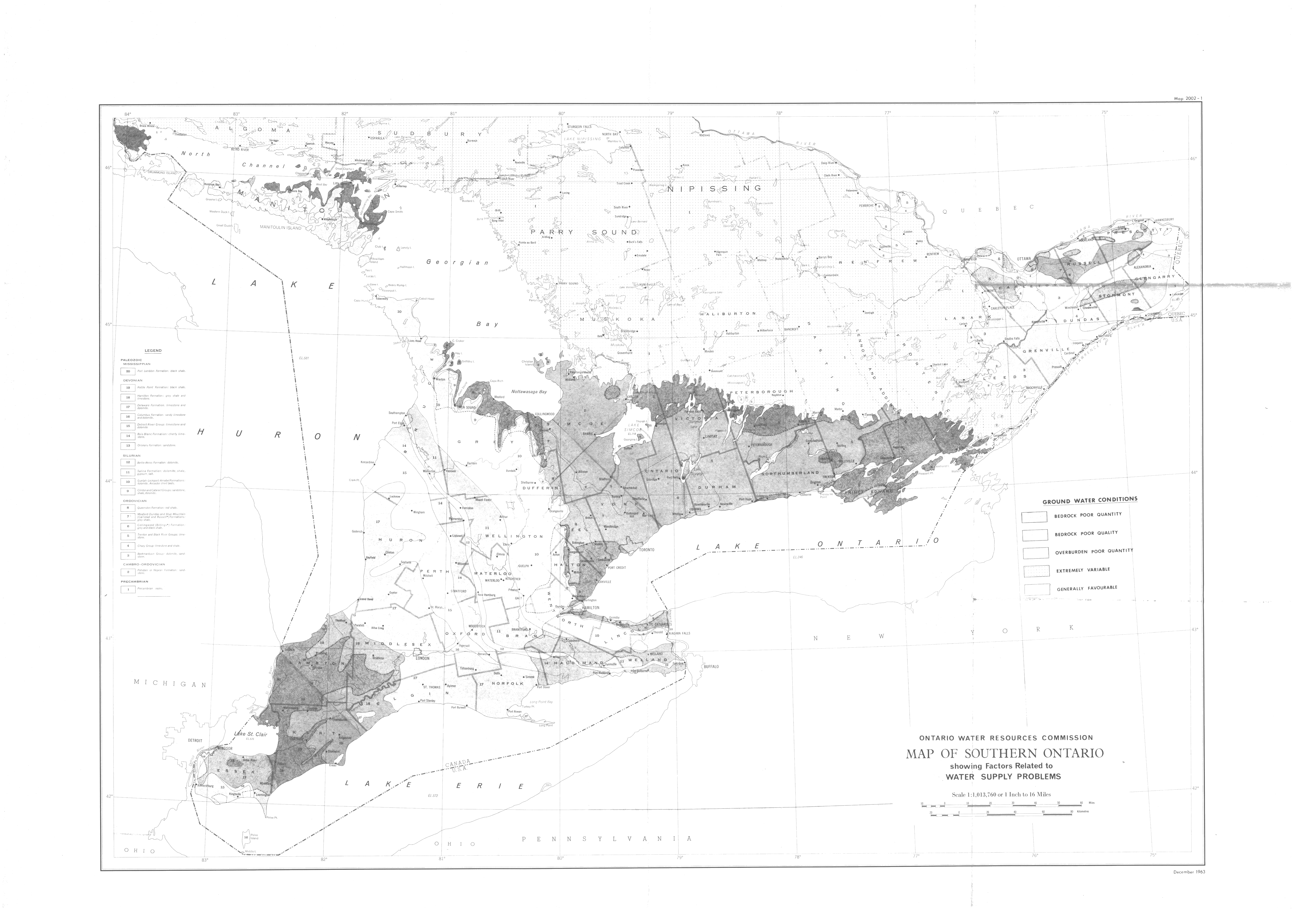
| Map Title | Map of Southern Ontario showing Factors Related to Water Supply Problems |
| Front/Back | Front |
| Blank | No |
| Physical Location | MAPFC |
| Cartographer | Ontario Water Resources Commission |
| Publisher | Ontario Water Resources Commission |
| Date | |
| Copyright Holder | Government |
| Map Type | Resource |
| Continent | North America |
| Country | Canada |
| State | Ontario |
| County | |
| Township | |
| Municipality | |
| Lat Ne | 46.165413 |
| Long Ne | -77.898867 |
| Lat Sw | 41.847615 |
| Long Sw | -83.959342 |
| Map Scale Text | 1 inch: 16 miles |
| Map Scale Ratio | 1:1,013,760 |
| Quality Score | 2 |
| Documentation Score | 2 |
| Georeference Algorithm | |
| Well Points | No |
| Notes | A map of Southern Ontario showing Factors Related to Water Supply Problems |