| Filename | Brittain_MAPFC_451_2018-06-29_1 |
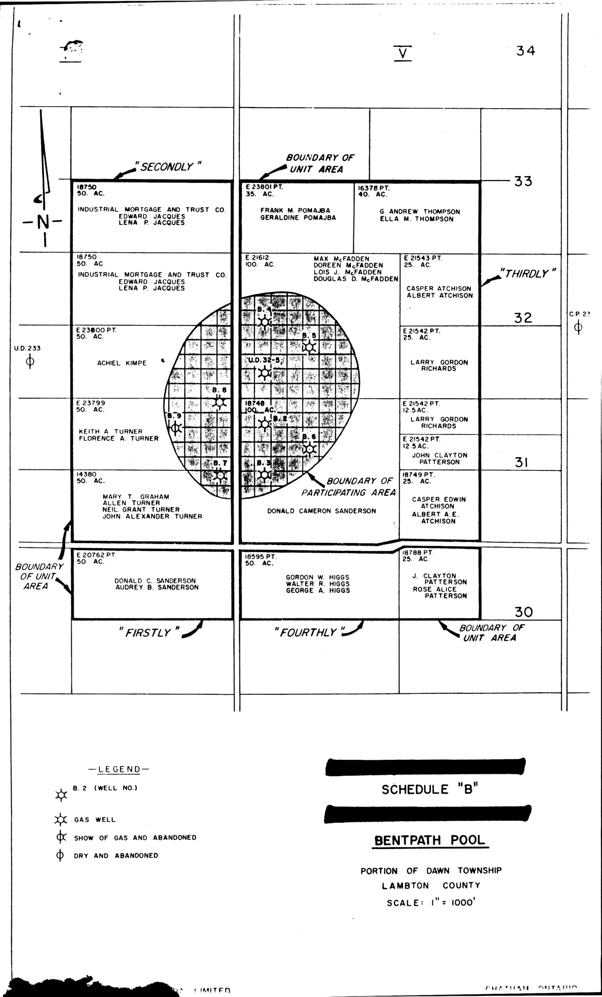
| Map Title | Schedule \'B\': Bentpath Pool |
| Front/Back | Front |
| Blank | No |
| Physical Location | MAPFC |
| Cartographer | Union Gas Company of Canada Ltd |
| Publisher | Union Gas Company of Canada Ltd |
| Date | |
| Copyright Holder | Private |
| Map Type | Resource |
| Continent | North America |
| Country | Canada |
| State | Ontario |
| County | Lambton |
| Township | Dawn |
| Municipality | |
| Lat Ne | 42.760229 |
| Long Ne | -82.1563 |
| Lat Sw | 42.734681 |
| Long Sw | -82.182377 |
| Map Scale Text | 1 inch: 1000 feet |
| Map Scale Ratio | 1:12,000 |
| Quality Score | 2 |
| Documentation Score | 3 |
| Georeference Algorithm | |
| Well Points | Yes |
| Notes | A map of Bentpath Pool in Dawn Township showing gas wells, lots, concessions, and land owners. |