| Filename | Brittain_MAPFC_246_2018-08-07_1 |
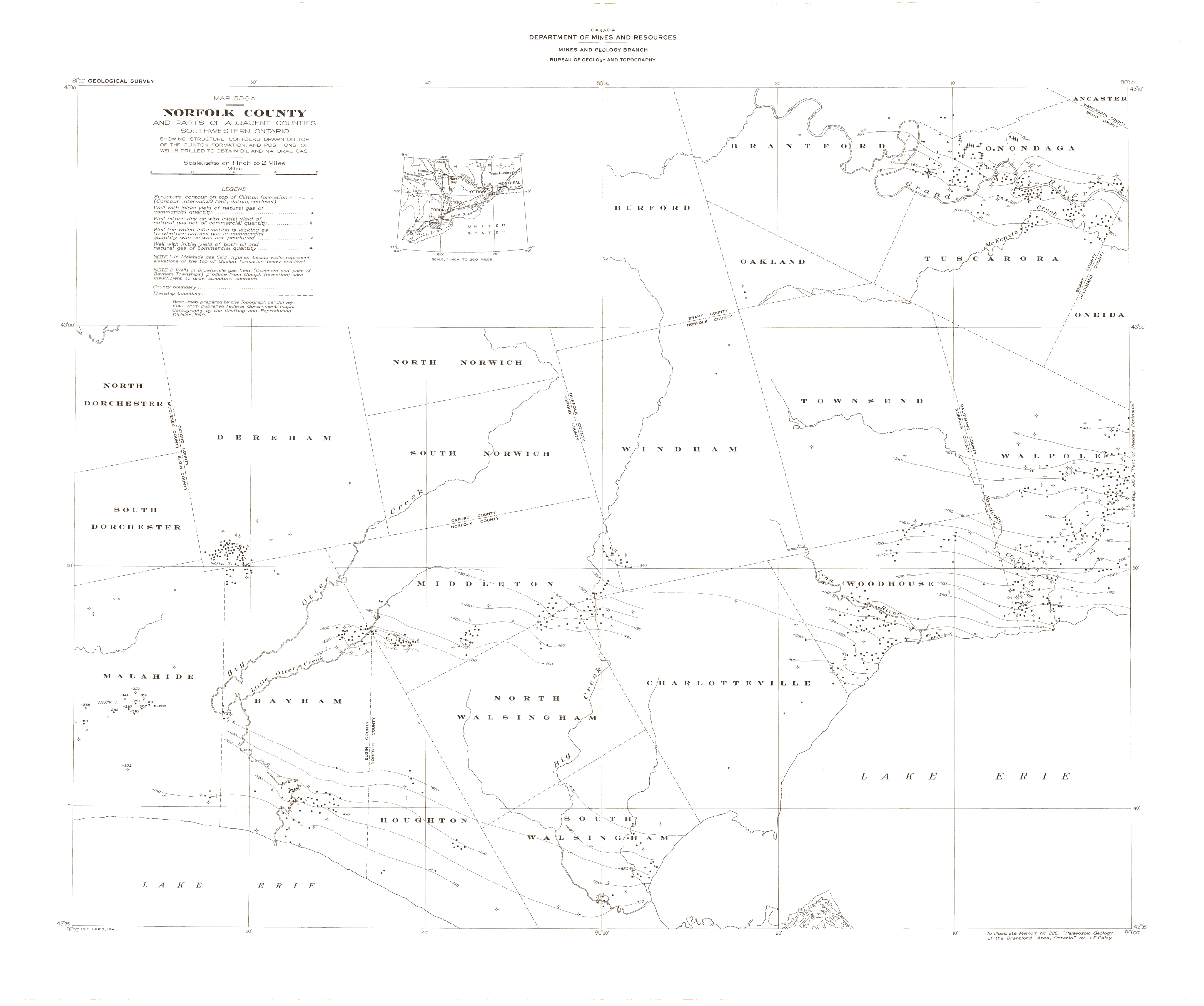
| Map Title | Norfolk County and Parts of Adjacent Counties Southwestern Ontario - Map 636A |
| Front/Back | Front |
| Blank | No |
| Physical Location | MAPFC |
| Cartographer | Department of Mines and Resources |
| Publisher | Department of Mines and Resources |
| Date | 1941-01-01 |
| Copyright Holder | Government |
| Map Type | Resource |
| Continent | North America |
| Country | Canada |
| State | Ontario |
| County | Norfolk |
| Township | |
| Municipality | |
| Lat Ne | 43.158034 |
| Long Ne | -80.055932 |
| Lat Sw | 42.654656 |
| Long Sw | -80.860041 |
| Map Scale Text | 1 inch: 2 miles |
| Map Scale Ratio | 1:126,720 |
| Quality Score | 2 |
| Documentation Score | 2 |
| Georeference Algorithm | |
| Well Points | Yes |
| Notes | A map of Norfolk County and parts of adjacent counties. |