No data to produce midpoint map.
| Filename | Brittain_MAPFC_239_2018-08-07_1 |
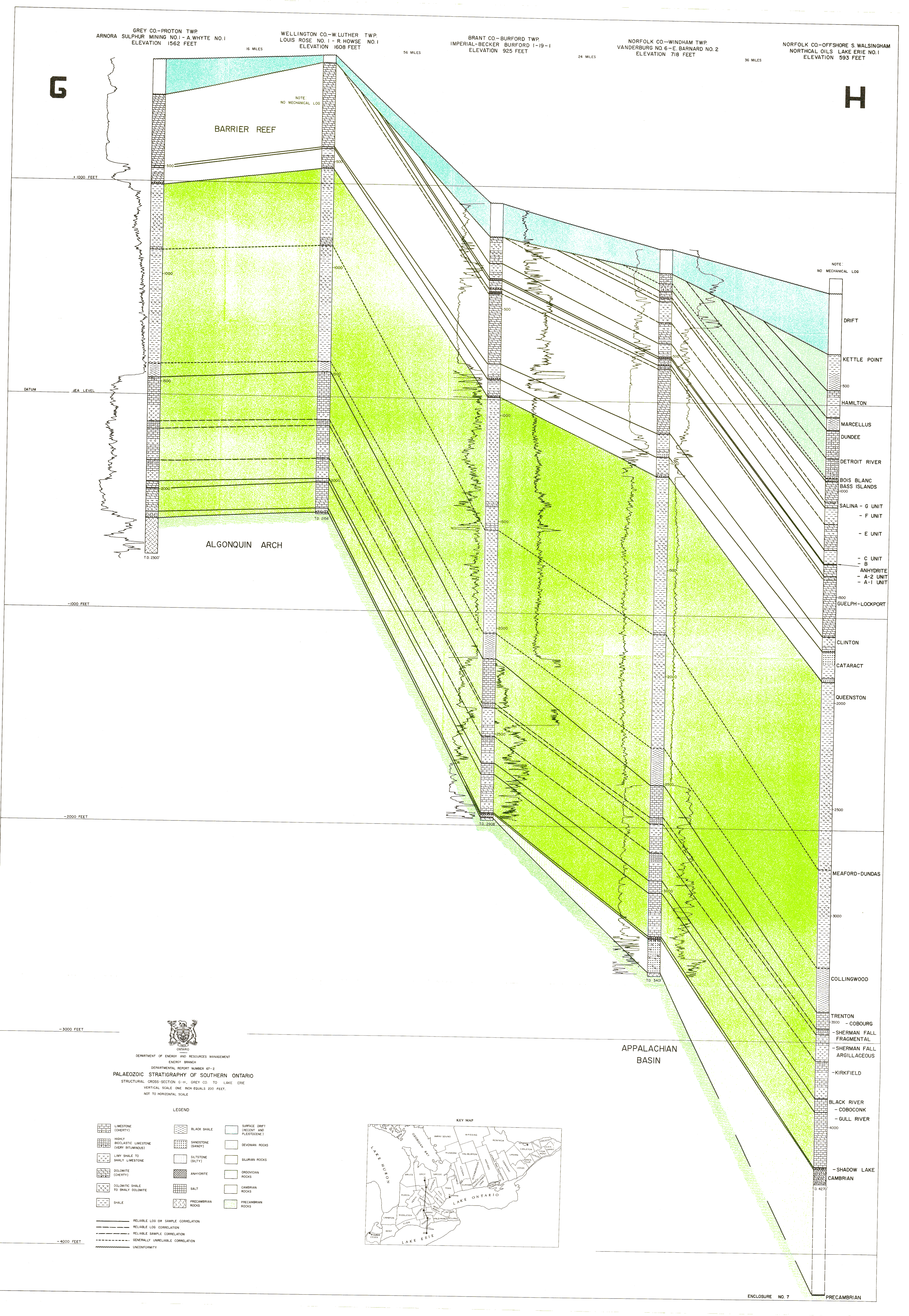
| Map Title | Paleozoic Stratigraphy of Southern Ontario - GH |
| Front/Back | Front |
| Blank | No |
| Physical Location | MAPFC |
| Cartographer | Department of Energy and Resource Management |
| Publisher | Department of Energy and Resources Management |
| Date | |
| Copyright Holder | Government |
| Map Type | Resource |
| Continent | North America |
| Country | Canada |
| State | Ontario |
| County | |
| Township | |
| Municipality | |
| Lat Ne | |
| Long Ne | |
| Lat Sw | |
| Long Sw | |
| Map Scale Text | 1 inch: 200 feet |
| Map Scale Ratio | 1:2,400 |
| Quality Score | 2 |
| Documentation Score | 2 |
| Georeference Algorithm | |
| Well Points | No |
| Notes | Paleozoic stratigraphy: structural cross section of G-H - Grey County to Lake Erie. |