|
Filename
|
Brittain_MAPFC_226_2018-08-07_1 |
|
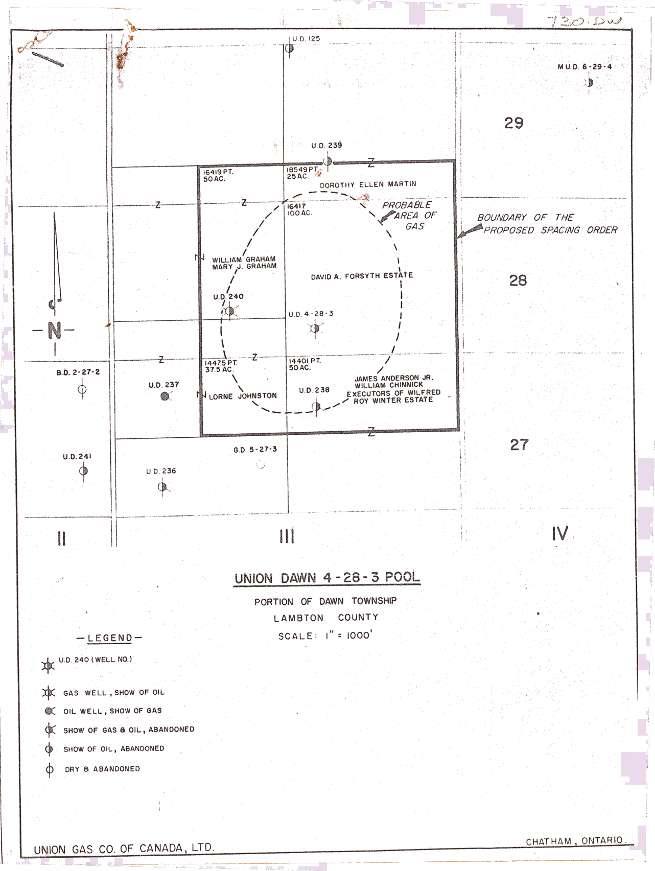
Map Title |
Union Dawn 4-28-3 Pool |
|
Front/Back |
Front |
|
Blank
|
No |
|
Physical Location |
MAPFC |
|
Cartographer
|
Union Gas Company of Canada Ltd |
|
Publisher
|
Union Gas Company of Canada, Limited |
|
Date
|
|
|
Copyright Holder |
Private |
|
Map Type |
Resource |
|
Continent
|
North America |
|
Country
|
Canada |
|
State
|
Ontario |
|
County
|
Lambton |
|
Township
|
Dawn |
|
Municipality
|
|
|
Lat Ne |
42.734148 |
|
Long Ne |
-82.17388 |
|
Lat Sw |
42.717714 |
|
Long Sw |
-82.225626 |
|
Map Scale Text |
1 inch: 1000 feet |
|
Map Scale Ratio |
1:12,000 |
|
Quality Score |
2 |
|
Documentation Score |
2 |
|
Georeference Algorithm |
|
|
Well Points |
Yes |
|
Notes
|
A map of the Union Dawn 4-28-3 pool with well points and boundaries. |