| Filename | Brittain_MAPFC_215_2018-08-07_1 |
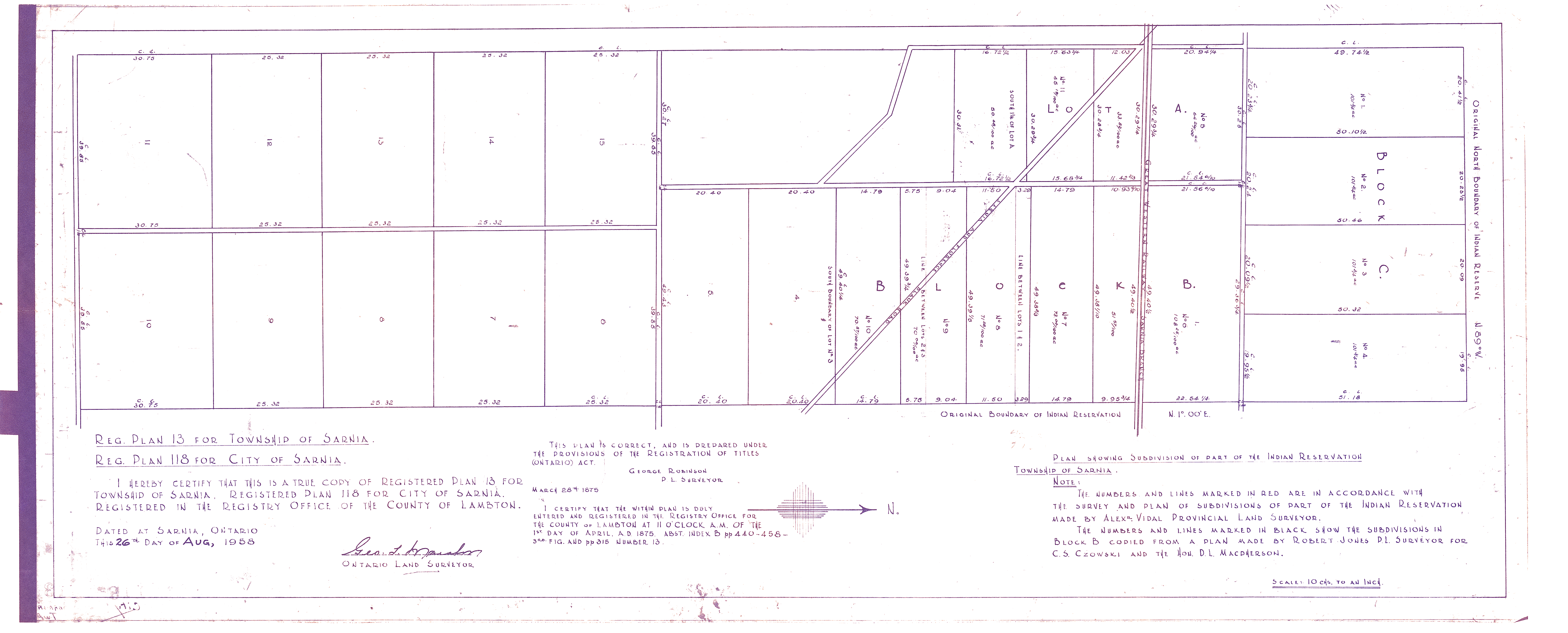
| Map Title | Plan Showing Subdivision of Part of the Indian Reservation, Township of Sarnia |
| Front/Back | Front |
| Blank | No |
| Physical Location | MAPFC |
| Cartographer | Alex Vidal Provincial Land Surveyor |
| Publisher | Registry Office of the County of Lambton |
| Date | 1958-08-26 |
| Copyright Holder | Government |
| Map Type | Resource |
| Continent | North America |
| Country | Canada |
| State | Ontario |
| County | |
| Township | |
| Municipality | |
| Lat Ne | 42.93604 |
| Long Ne | -82.376383 |
| Lat Sw | 42.912974 |
| Long Sw | -82.453851 |
| Map Scale Text | 1 inch: 10 chains (660 ft) |
| Map Scale Ratio | 1:7,920 |
| Quality Score | 2 |
| Documentation Score | 1 |
| Georeference Algorithm | |
| Well Points | No |
| Notes | A map showing a subdivision plan of the Indian Reservation in the Township of Sarnia. |