| Filename | Brittain_MAPVFC_273_2018-08-08_1 |
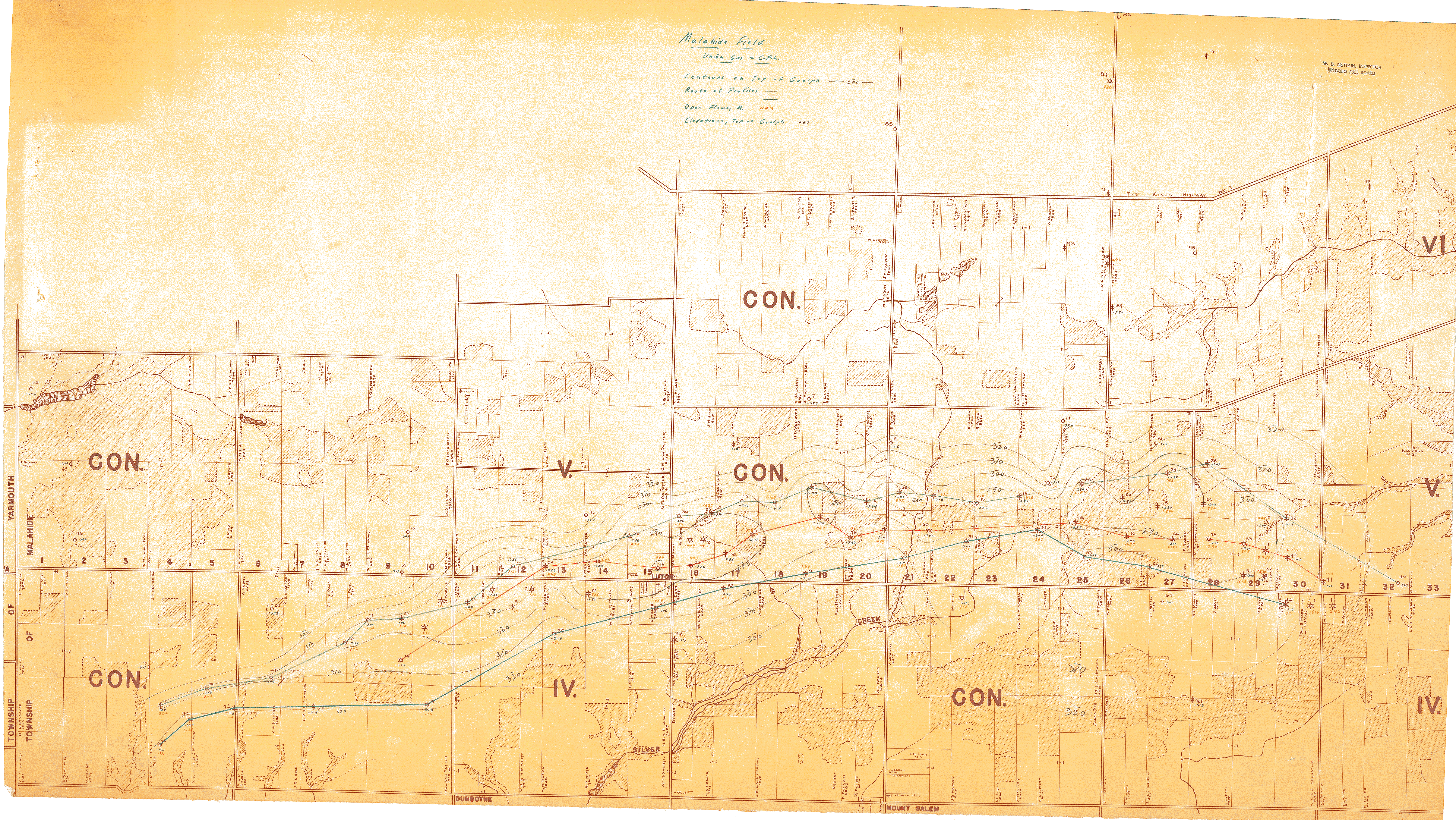
| Map Title | Malahide Field |
| Front/Back | Front |
| Blank | No |
| Physical Location | MAPVFC |
| Cartographer | Union Gas + CPH |
| Publisher | Union Gas + CPH |
| Date | |
| Copyright Holder | Private |
| Map Type | Resource |
| Continent | North America |
| Country | Canada |
| State | Ontario |
| County | |
| Township | |
| Municipality | |
| Lat Ne | 42.753272 |
| Long Ne | -80.868176 |
| Lat Sw | 42.713664 |
| Long Sw | -81.034577 |
| Map Scale Text | |
| Map Scale Ratio | |
| Quality Score | 2 |
| Documentation Score | 2 |
| Georeference Algorithm | |
| Well Points | Yes |
| Notes | A map of Malahide Field showing contours on top of Guelph, route profiles, open flows, lots, concessions, and well points. |