| Filename | Brittain_MAPH_69_2018-08-02_1 |
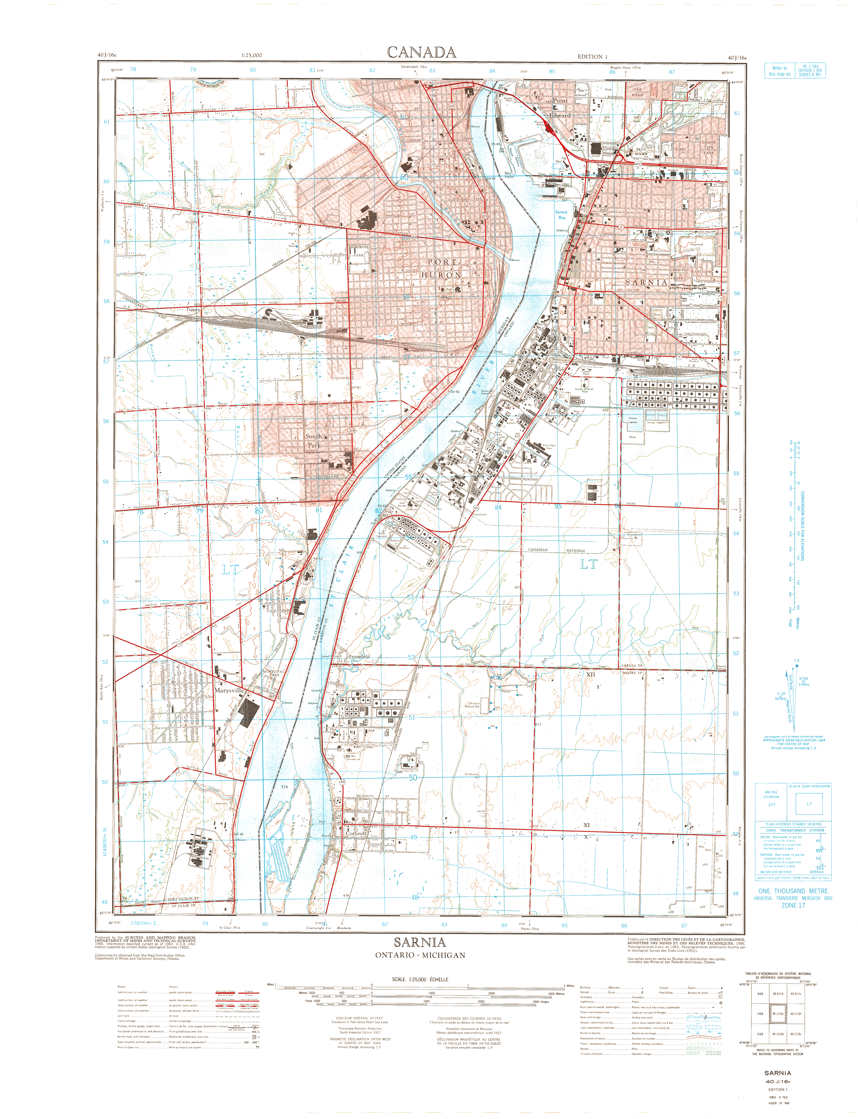
| Map Title | Sarnia along the Canada-USA Border |
| Front/Back | Front |
| Blank | No |
| Physical Location | MAPH |
| Cartographer | Department of Mines and Technical Surveys |
| Publisher | Department of Mines and Technical Surveys |
| Date | 1965-01-01 |
| Copyright Holder | Government |
| Map Type | Physical |
| Continent | North America |
| Country | Canada |
| State | Ontario |
| County | |
| Township | |
| Municipality | |
| Lat Ne | 43.000232 |
| Long Ne | -82.377083 |
| Lat Sw | 42.875333 |
| Long Sw | -82.500259 |
| Map Scale Text | |
| Map Scale Ratio | 1: 25,000 |
| Quality Score | 2 |
| Documentation Score | 1 |
| Georeference Algorithm | |
| Well Points | No |
| Notes | A map showing Sarnia along the Canadian-United States border. |