| Filename | Brittain_MAPH_54_2018-08-02_1 |
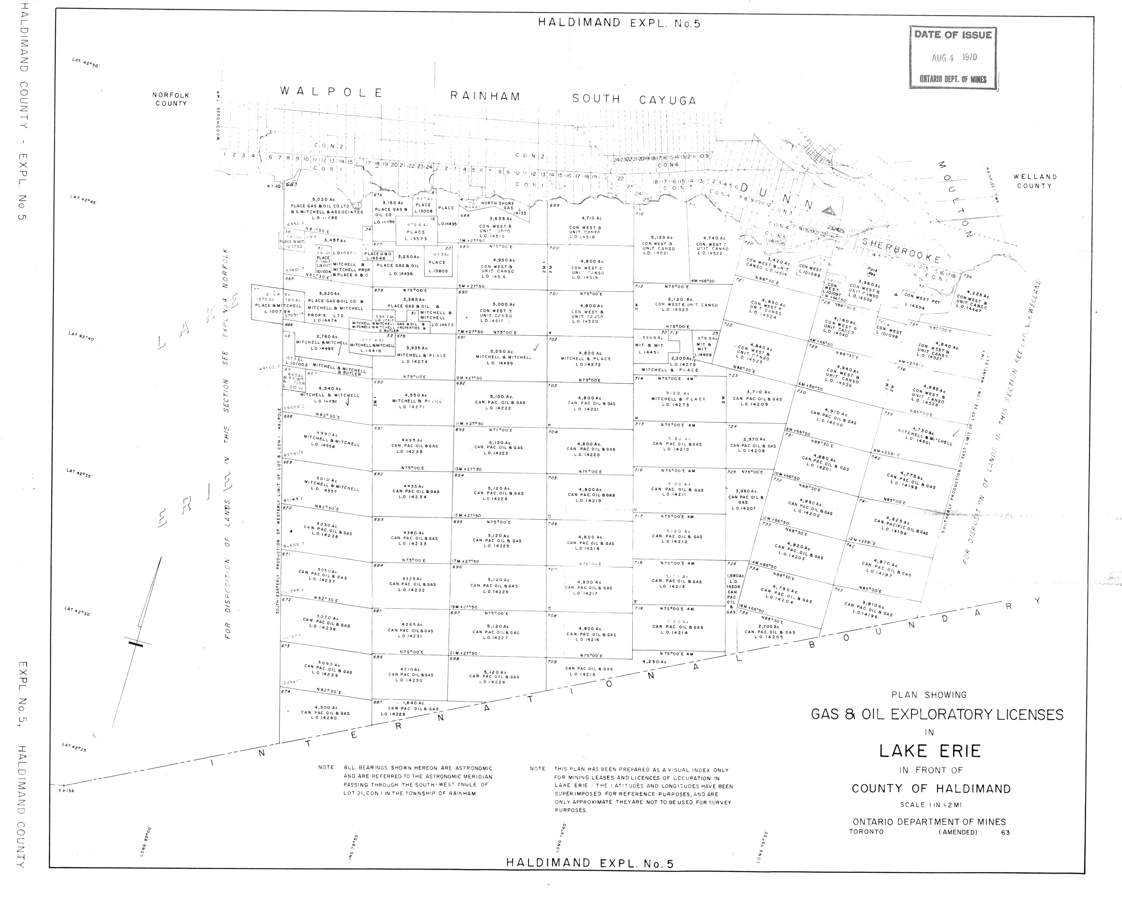
| Map Title | County of Haldimand - Lake Erie Licenses |
| Front/Back | Front |
| Blank | No |
| Physical Location | MAPH |
| Cartographer | |
| Publisher | Ontario Department of Mines |
| Date | 1970-08-04 |
| Copyright Holder | Government |
| Map Type | Resource |
| Continent | North America |
| Country | Canada |
| State | Ontario |
| County | Haldimand |
| Township | |
| Municipality | |
| Lat Ne | 42.923451 |
| Long Ne | -79.448999 |
| Lat Sw | 42.42344 |
| Long Sw | -80.004326 |
| Map Scale Text | 1 inch: 2 miles |
| Map Scale Ratio | 1:126,720 |
| Quality Score | 2 |
| Documentation Score | 2 |
| Georeference Algorithm | |
| Well Points | No |
| Notes | A map of the County of Haldimand showing licences in Lake Erie with lots and concessions. |