| Filename | Brittain_MAPH_44_2018-08-02_1 |
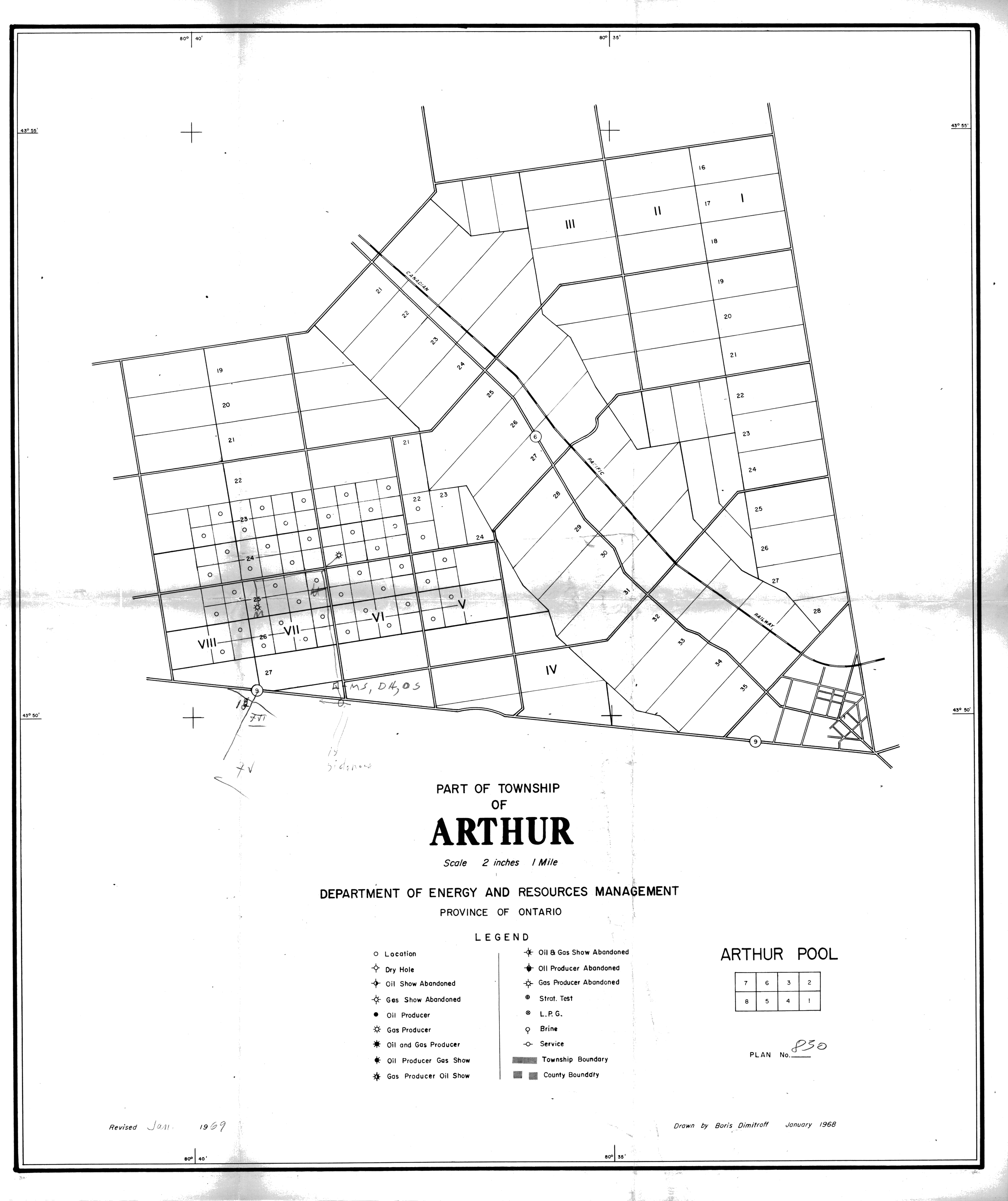
| Map Title | Arthur Township with hand drawn well locations |
| Front/Back | Front |
| Blank | No |
| Physical Location | MAPH |
| Cartographer | Boris Dimitroff |
| Publisher | Department of Energy Resources Management |
| Date | 1969-01-01 |
| Copyright Holder | Government |
| Map Type | Resource |
| Continent | North America |
| Country | Canada |
| State | Ontario |
| County | |
| Township | Arthur |
| Municipality | |
| Lat Ne | 43.901101 |
| Long Ne | -80.530258 |
| Lat Sw | 43.837444 |
| Long Sw | -80.670245 |
| Map Scale Text | 2 inches: 1 mile |
| Map Scale Ratio | 1:31,680 |
| Quality Score | 2 |
| Documentation Score | 2 |
| Georeference Algorithm | |
| Well Points | Yes |
| Notes | A map showing Arthur Township with hand drawn well locations on a property. |