| Filename | Brittain_MAPH_431_2018-08-13_1 |
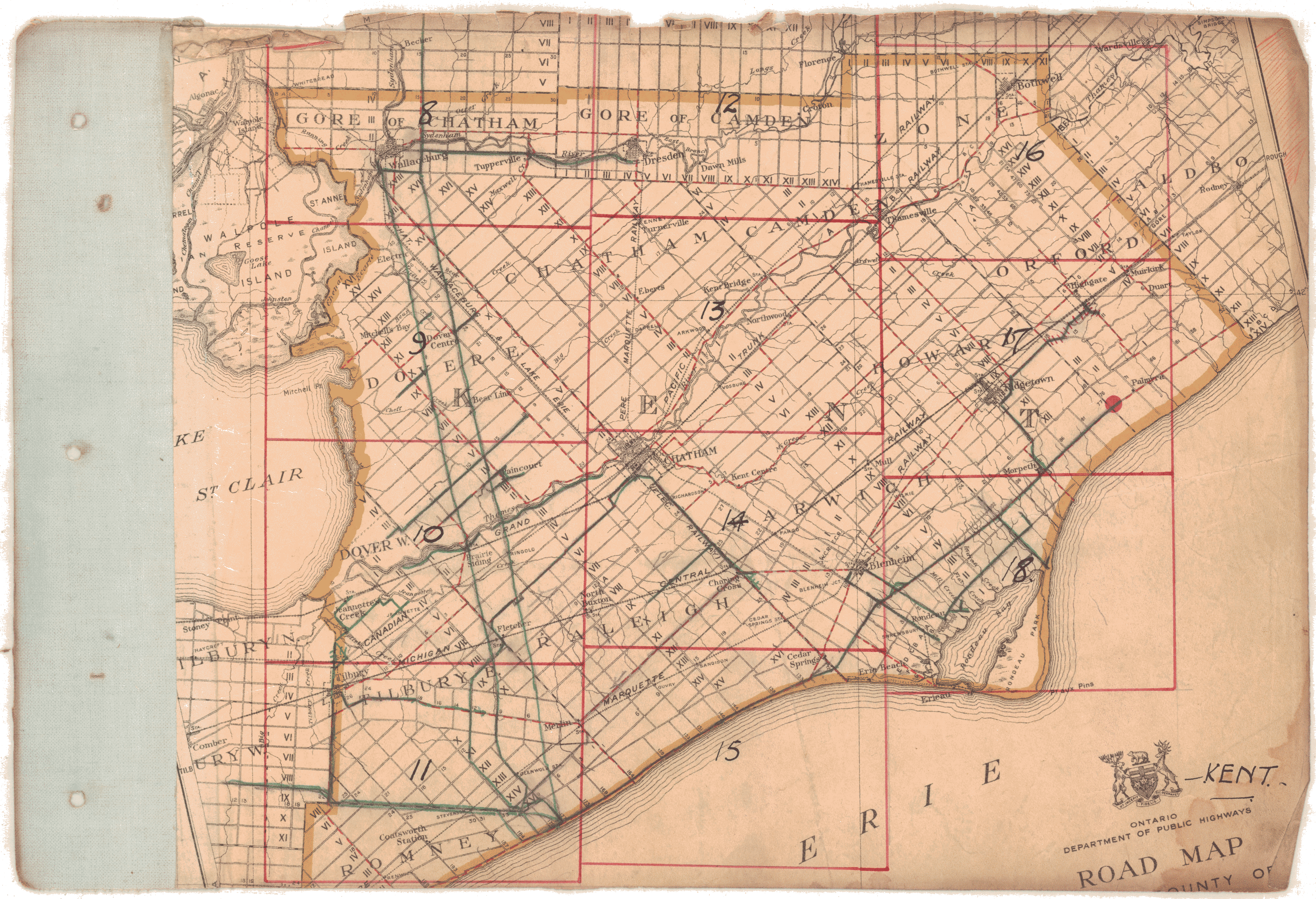
| Map Title | Road Map Kent |
| Front/Back | Front |
| Blank | No |
| Physical Location | MAPH |
| Cartographer | Ontario Department of Public Highways |
| Publisher | Ontario Department of Public Highways |
| Date | |
| Copyright Holder | Government |
| Map Type | Political |
| Continent | North America |
| Country | Canada |
| State | Ontario |
| County | |
| Township | |
| Municipality | |
| Lat Ne | 42.607782 |
| Long Ne | -81.834567 |
| Lat Sw | 42.14059 |
| Long Sw | -82.459634 |
| Map Scale Text | |
| Map Scale Ratio | |
| Quality Score | 2 |
| Documentation Score | 2 |
| Georeference Algorithm | |
| Well Points | No |
| Notes | A road map of Kent County with roads and concessions. |