| Filename | Brittain_MAPH_414_2018-08-08_1 |
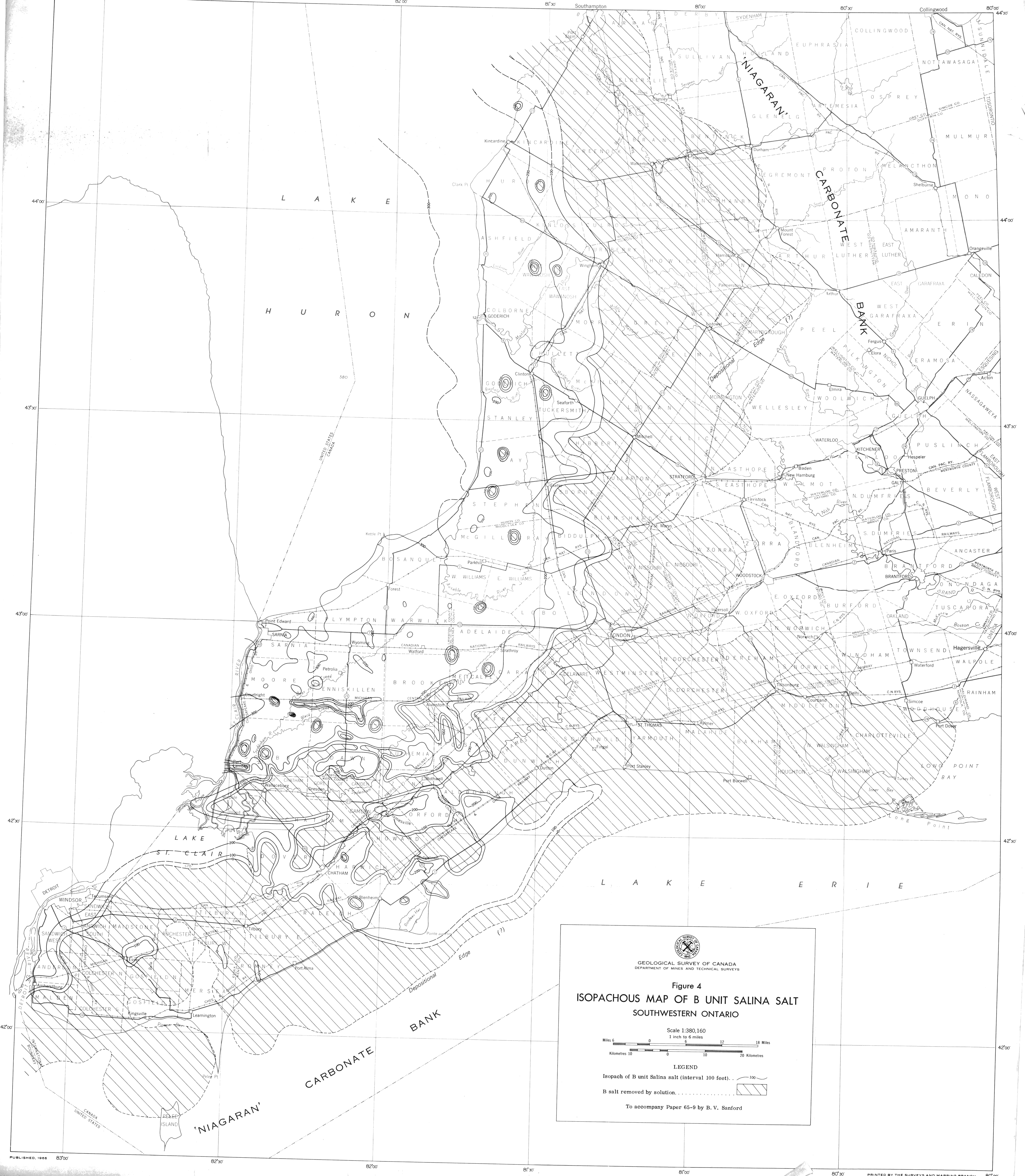
| Map Title | Isopachous Map of B Unit Salina Salt - Figure 4 |
| Front/Back | Front |
| Blank | No |
| Physical Location | MAPH |
| Cartographer | Geological Survey of Canada |
| Publisher | Department of Mines and Technical Surveys |
| Date | 1966-01-01 |
| Copyright Holder | Government |
| Map Type | Resource |
| Continent | North America |
| Country | Canada |
| State | Ontario |
| County | |
| Township | |
| Municipality | |
| Lat Ne | 44.48486 |
| Long Ne | -79.965231 |
| Lat Sw | 41.74813 |
| Long Sw | -83.248962 |
| Map Scale Text | 1 inch: 6 miles |
| Map Scale Ratio | 1:380,160 |
| Quality Score | 2 |
| Documentation Score | 2 |
| Georeference Algorithm | |
| Well Points | No |
| Notes | An isopachous map of B Unit Salina Salt in southwestern Ontario. |