| Filename | Brittain_MAPH_21_2018-08-01_1 |
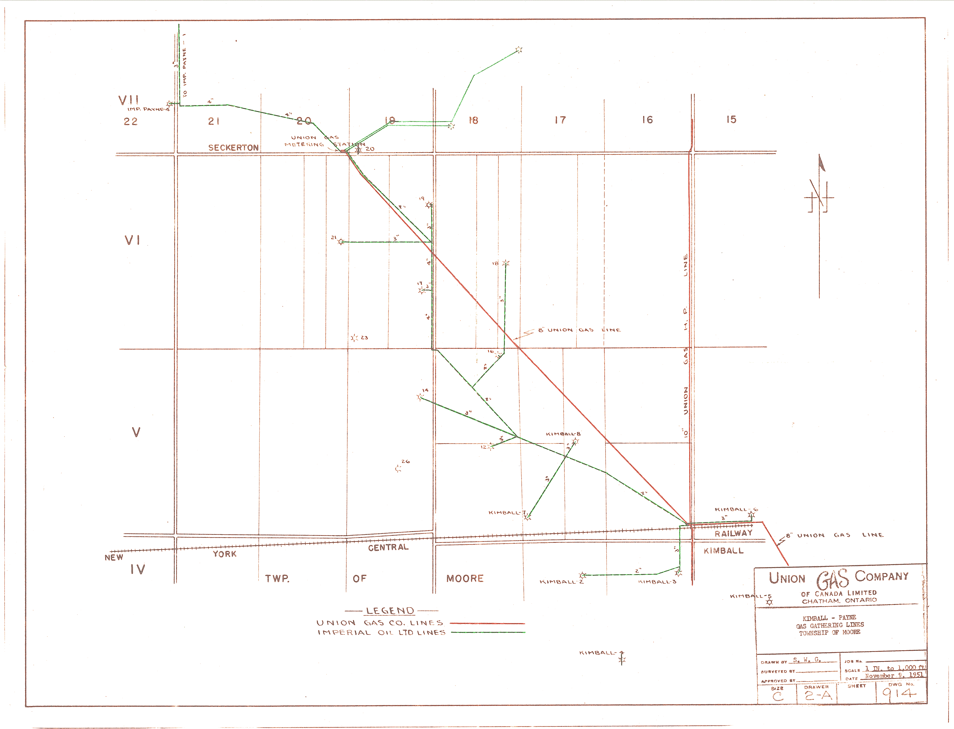
| Map Title | Kimball-Payne Gas Gathering Lines, Township of Moore |
| Front/Back | Front |
| Blank | No |
| Physical Location | MAPH |
| Cartographer | S. W. G. |
| Publisher | Union Gas Company of Canada, Limited |
| Date | 1951-11-09 |
| Copyright Holder | Private |
| Map Type | Resource |
| Continent | North America |
| Country | Canada |
| State | Ontario |
| County | |
| Township | Moore |
| Municipality | |
| Lat Ne | 42.842936 |
| Long Ne | -82.336564 |
| Lat Sw | 42.810564 |
| Long Sw | -82.399525 |
| Map Scale Text | 1 inch: 1000 feet |
| Map Scale Ratio | 1:12,000 |
| Quality Score | 2 |
| Documentation Score | 2 |
| Georeference Algorithm | |
| Well Points | Yes |
| Notes | A map showing gas lines in Kimball-Payne. |