| Filename | Brittain_MAPH_196_2018-08-07_1 |
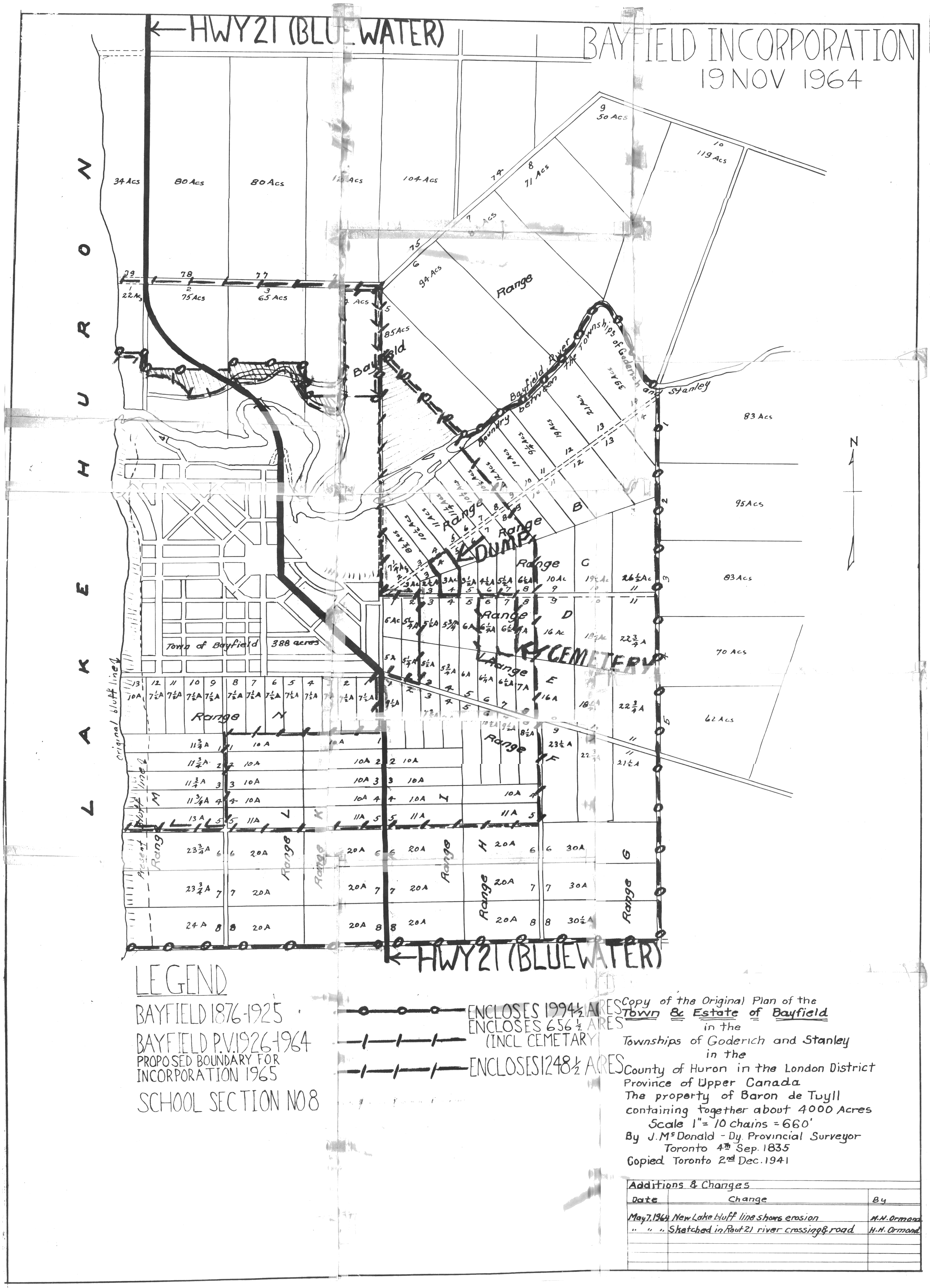
| Map Title | Copy of the Original Plan of the Town 8C - Estate of Bayfield |
| Front/Back | Front |
| Blank | No |
| Physical Location | MAPH |
| Cartographer | J. McDonald |
| Publisher | |
| Date | 1964-11-19 |
| Copyright Holder | Private |
| Map Type | Political |
| Continent | North America |
| Country | Canada |
| State | Ontario |
| County | Huron |
| Township | |
| Municipality | Goderich |
| Lat Ne | 43.586706 |
| Long Ne | -81.667482 |
| Lat Sw | 43.543061 |
| Long Sw | -81.710216 |
| Map Scale Text | 1 inch: 10 chains (660 ft) |
| Map Scale Ratio | 1:7,920 |
| Quality Score | 2 |
| Documentation Score | 1 |
| Georeference Algorithm | |
| Well Points | No |
| Notes | A map of Baron de Tuyll's 4,000 acre property broken up into lots with the location of the dump, cemetery and Highway 21. |