| Filename | Brittain_MAPH_194_2018-08-07_1 |
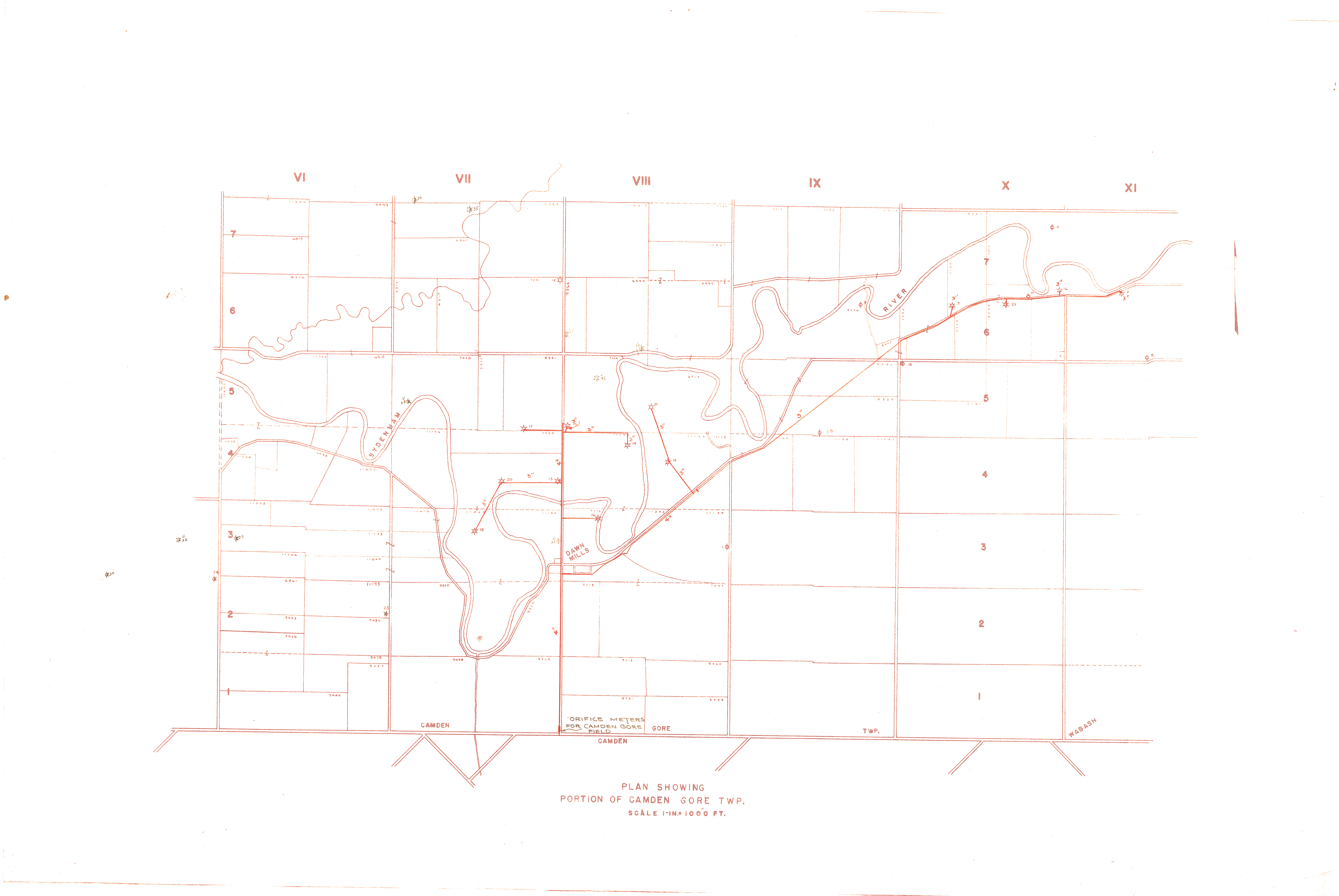
| Map Title | Plan Showing Portion of Camden Gore Township |
| Front/Back | Front |
| Blank | No |
| Physical Location | MAPH |
| Cartographer | |
| Publisher | |
| Date | |
| Copyright Holder | |
| Map Type | Resource |
| Continent | North America |
| Country | Canada |
| State | Ontario |
| County | |
| Township | Camden |
| Municipality | |
| Lat Ne | 42.609699 |
| Long Ne | -82.082966 |
| Lat Sw | 42.573509 |
| Long Sw | -82.169789 |
| Map Scale Text | 1 inch: 1000 feet |
| Map Scale Ratio | 1:12,000 |
| Quality Score | 2 |
| Documentation Score | 2 |
| Georeference Algorithm | |
| Well Points | Yes |
| Notes | A map showing a portion of Camden Gore Township with several well points. |