| Filename | Brittain_MAPH_177_2018-08-07_1 |
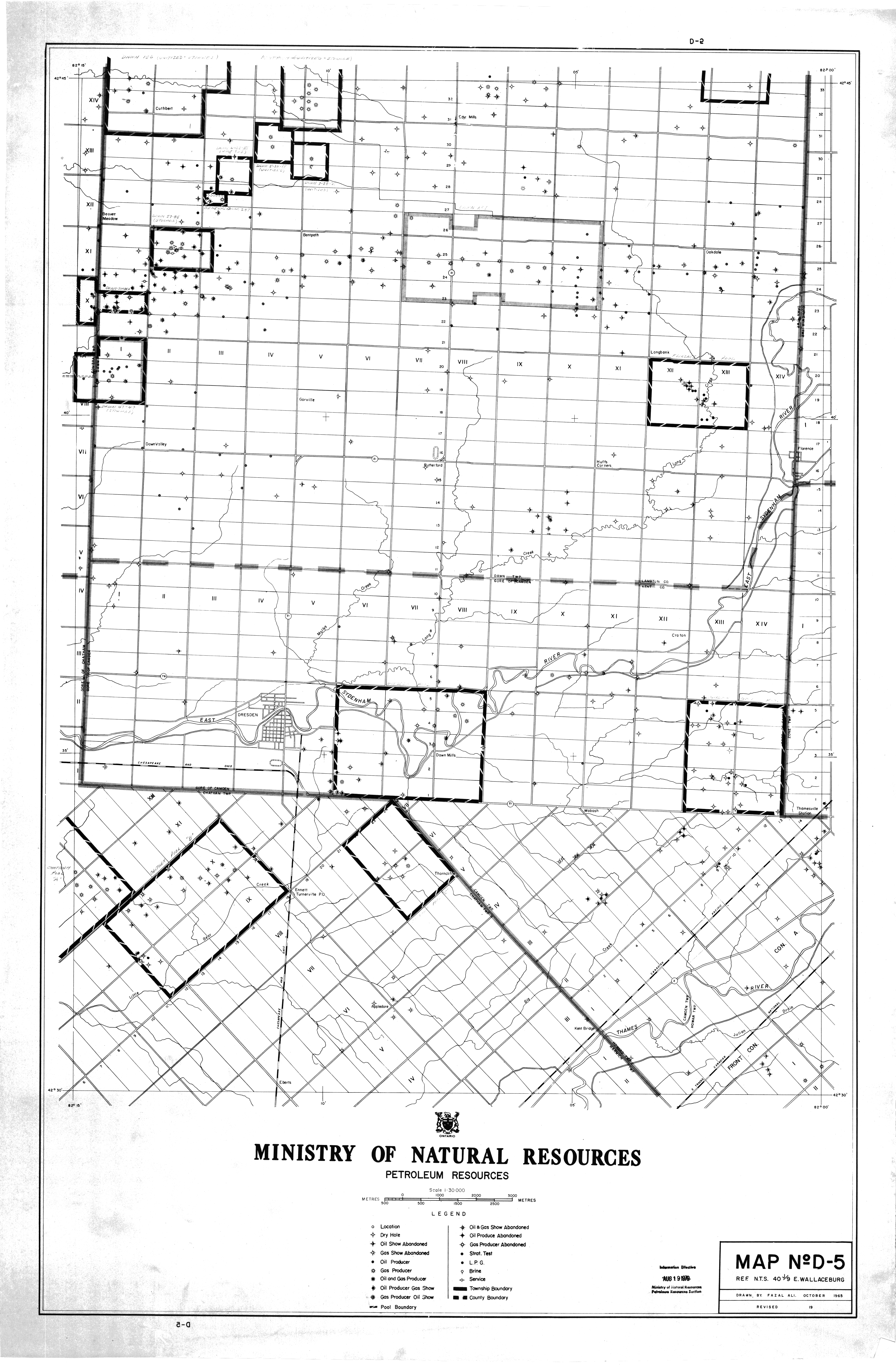
| Map Title | Map No. D-5 - Dresden Area |
| Front/Back | Front |
| Blank | No |
| Physical Location | MAPH |
| Cartographer | Fazal Ali |
| Publisher | Ministry of Natural Resources - Petroleum Resources |
| Date | 1966-04-01 |
| Copyright Holder | Government |
| Map Type | Resource |
| Continent | North America |
| Country | Canada |
| State | Ontario |
| County | |
| Township | |
| Municipality | |
| Lat Ne | 42.74683 |
| Long Ne | -82.004915 |
| Lat Sw | 42.494362 |
| Long Sw | -82.193659 |
| Map Scale Text | 1: 500 meters |
| Map Scale Ratio | 1:30,000 |
| Quality Score | 2 |
| Documentation Score | 2 |
| Georeference Algorithm | |
| Well Points | Yes |
| Notes | A map showing well points, county boundaries, and pool boundaries in the Dresden area. |