| Filename | Brittain_MAPH_15_2018-08-01_1 |
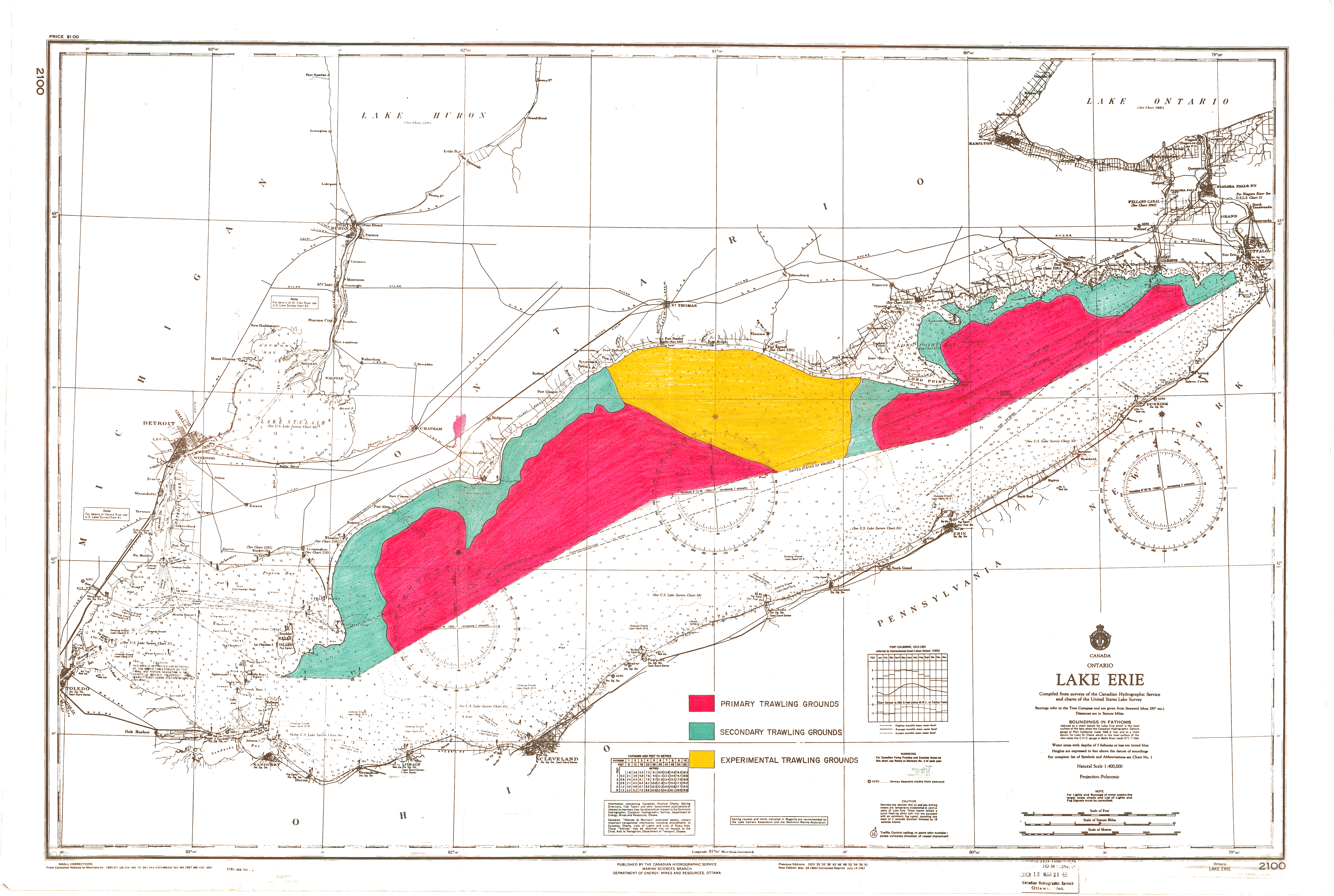
| Map Title | Lake Erie Trawling Grounds |
| Front/Back | Front |
| Blank | No |
| Physical Location | MAPH |
| Cartographer | Canadian Hydrographic Service Marine Sciences Branch |
| Publisher | Department of Energy, Mines and Resources |
| Date | 1969-03-21 |
| Copyright Holder | Government |
| Map Type | Resource |
| Continent | North America |
| Country | Canada |
| State | Ontario |
| County | |
| Township | |
| Municipality | |
| Lat Ne | 43.616568 |
| Long Ne | -78.532573 |
| Lat Sw | 41.251805 |
| Long Sw | -83.498403 |
| Map Scale Text | 1 inch: 1 mile |
| Map Scale Ratio | 1:63,360 |
| Quality Score | 2 |
| Documentation Score | 2 |
| Georeference Algorithm | |
| Well Points | No |
| Notes | A coloured map showing primary, secondary and experimental trawling grounds. |