| Filename | Brittain_MAPH_126_2018-08-03_1 |
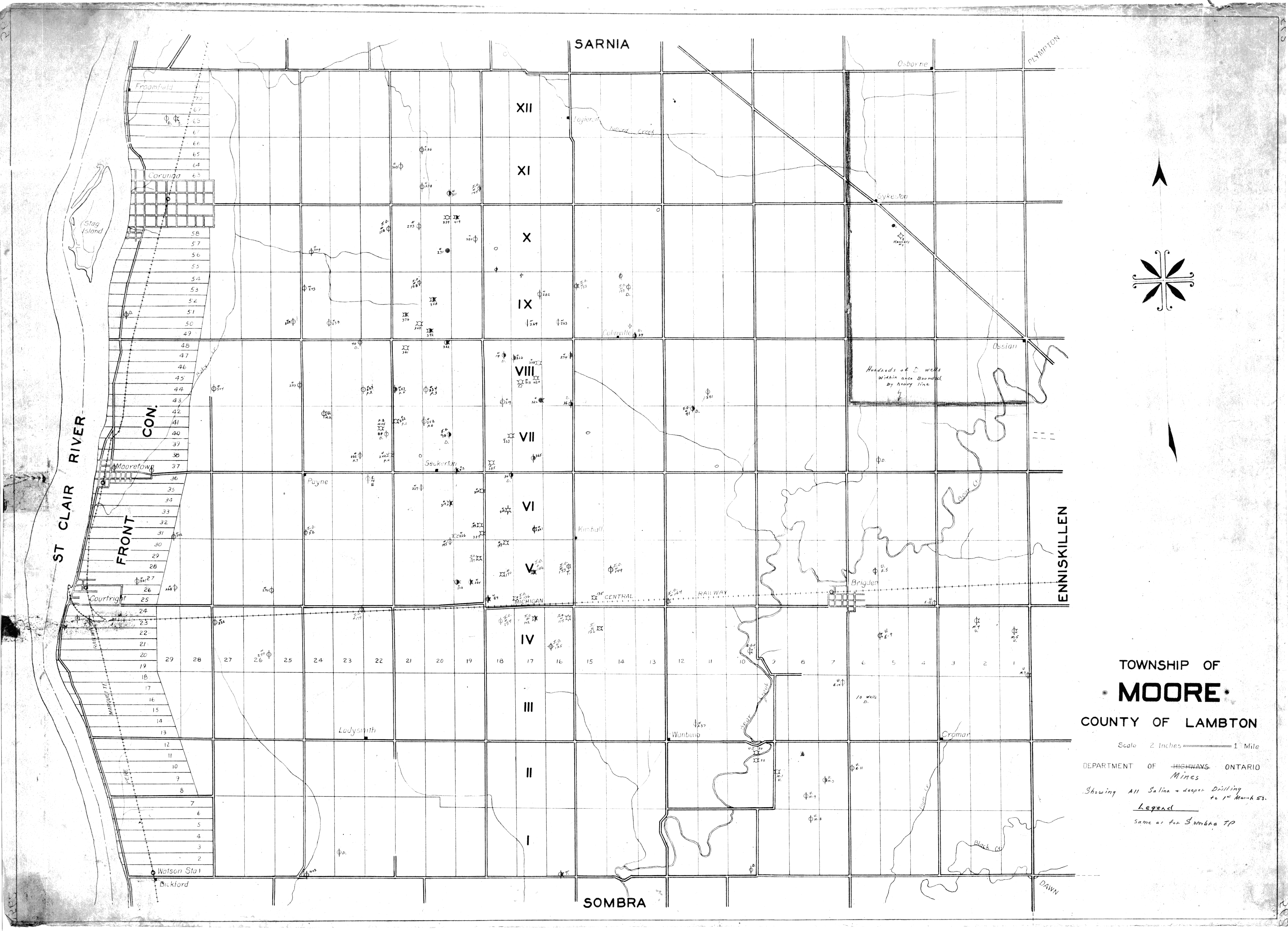
| Map Title | Township of Moore, County of Lambton |
| Front/Back | Front |
| Blank | No |
| Physical Location | MAPH |
| Cartographer | Department of Mines Ontario |
| Publisher | Department of Mines Ontario |
| Date | |
| Copyright Holder | Government |
| Map Type | Resource |
| Continent | North America |
| Country | Canada |
| State | Ontario |
| County | Lambton |
| Township | Moore |
| Municipality | |
| Lat Ne | 42.908301 |
| Long Ne | -82.235275 |
| Lat Sw | 42.765852 |
| Long Sw | -82.478722 |
| Map Scale Text | 2 inches: 1 mile |
| Map Scale Ratio | 1:31,680 |
| Quality Score | 2 |
| Documentation Score | 2 |
| Georeference Algorithm | |
| Well Points | Yes |
| Notes | A map showing Salina and deeper drilling well points to March 1, 1951 in Moore Township. |