| Filename | Brittain_MAPH_111_2018-08-03_1 |
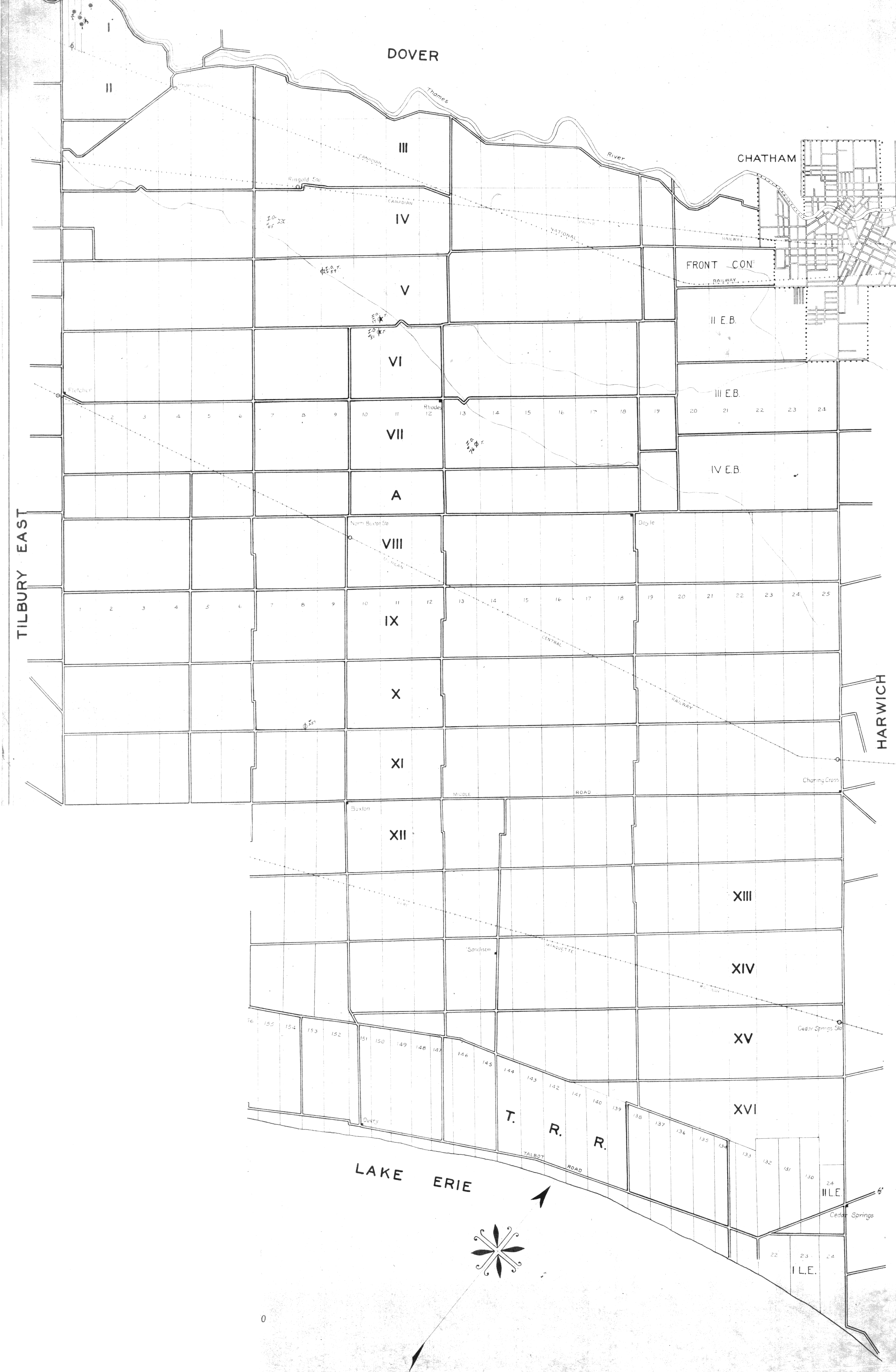
| Map Title | Southwestern Ontario Map with Lots, Concessions, and Well Points |
| Front/Back | Front |
| Blank | No |
| Physical Location | MAPH |
| Cartographer | |
| Publisher | |
| Date | |
| Copyright Holder | |
| Map Type | Resource |
| Continent | North America |
| Country | Canada |
| State | Ontario |
| County | |
| Township | |
| Municipality | |
| Lat Ne | 42.409257 |
| Long Ne | -82.194681 |
| Lat Sw | 42.195738 |
| Long Sw | -82.168468 |
| Map Scale Text | |
| Map Scale Ratio | |
| Quality Score | 2 |
| Documentation Score | 2 |
| Georeference Algorithm | |
| Well Points | Yes |
| Notes | A map showing areas within Tilbury East, Dover, Chatham, Harwich and Lake Erie with lots, concessions and well points. |