| Filename | Brittain_MAPFC_461_2018-08-10_1 |
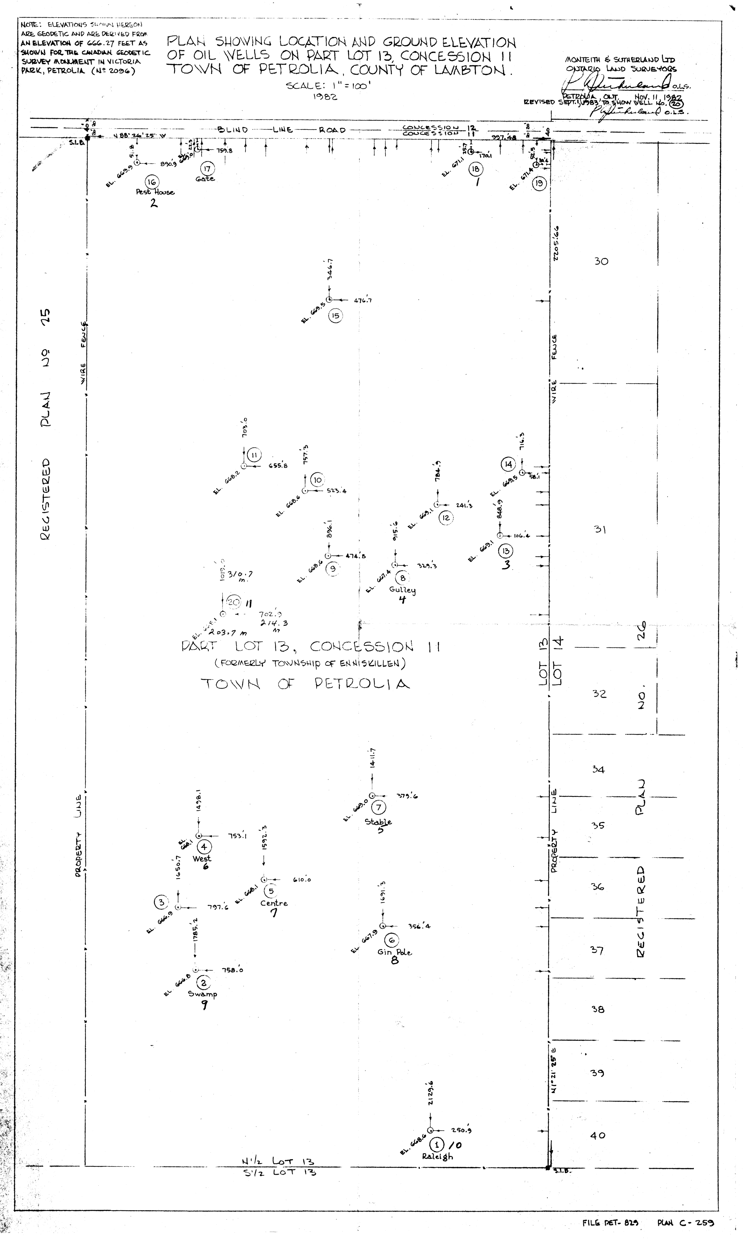
| Map Title | Plan Showing Location and Ground Elevation of Oil Wells - Lot 13, Con 11, Town of Petrolia, County of Lambton |
| Front/Back | Front |
| Blank | No |
| Physical Location | MAPFC |
| Cartographer | Monteith & Sutherland Limited, Ontario Land Surveyors |
| Publisher | Monteith & Sutherland Limited, Ontario Land Surveyors |
| Date | 1982-11-11 |
| Copyright Holder | Private |
| Map Type | Resource |
| Continent | North America |
| Country | Canada |
| State | Ontario |
| County | Lambton |
| Township | |
| Municipality | |
| Lat Ne | 42.893893 |
| Long Ne | -82.136197 |
| Lat Sw | 42.881818 |
| Long Sw | -82.147378 |
| Map Scale Text | 1 inch: 100 feet |
| Map Scale Ratio | 1:1,200 |
| Quality Score | 2 |
| Documentation Score | 3 |
| Georeference Algorithm | |
| Well Points | Yes |
| Notes | A map showing a plan with the location and ground elevation of oil wells on Lot 13, Con 11 of the Town of Petrolia in the County of Lambton. |