| Filename | Brittain_MAPFC_368_2018-08-10_1 |
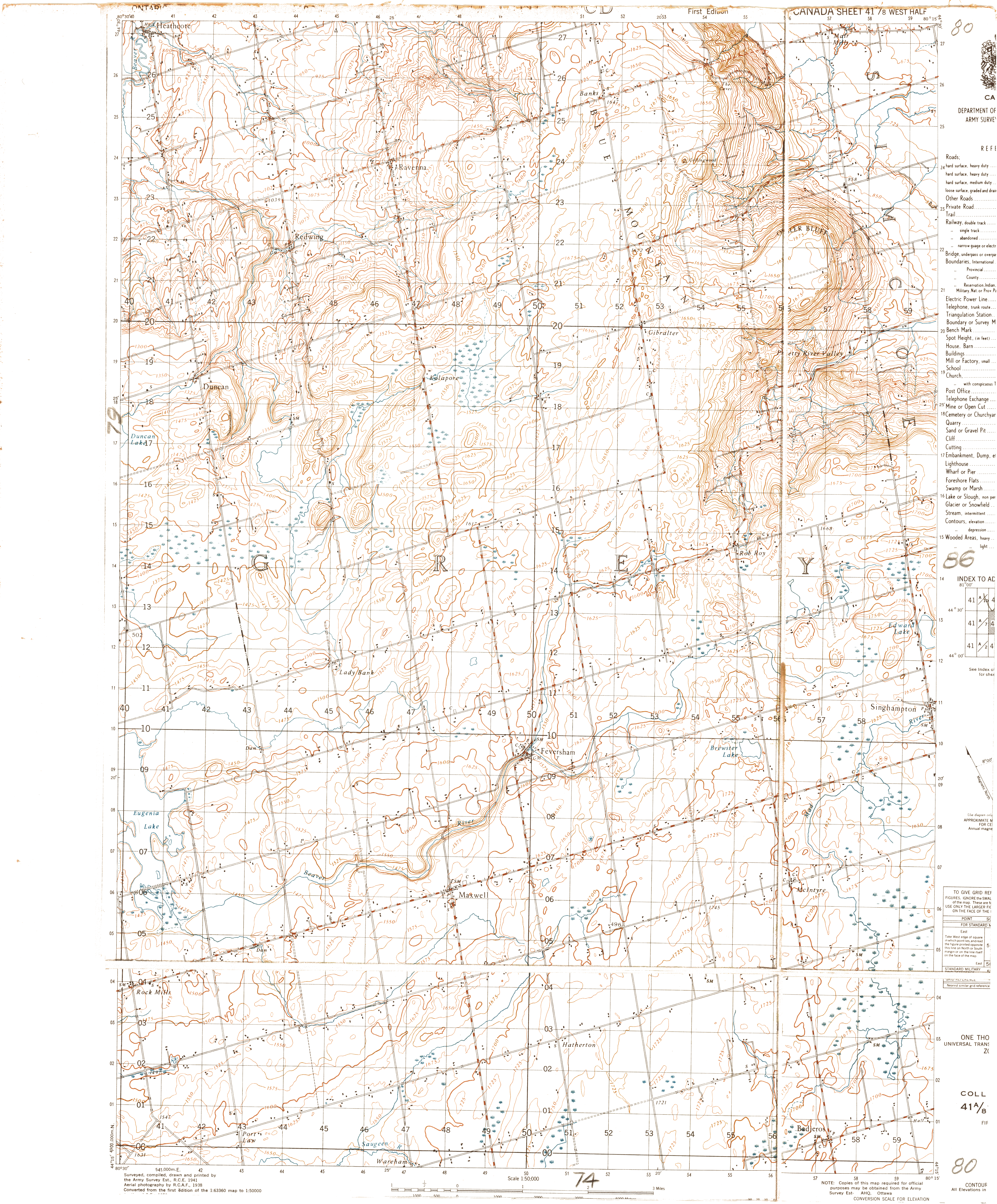
| Map Title | Collingwood (Sheet 41/8 West Half) - Map 80 |
| Front/Back | Front |
| Blank | No |
| Physical Location | MAPFC |
| Cartographer | Department of National Defence Army Survey Establishment |
| Publisher | Department of National Defence |
| Date | 1950-01-01 |
| Copyright Holder | Government |
| Map Type | Resource |
| Continent | North America |
| Country | Canada |
| State | Ontario |
| County | |
| Township | |
| Municipality | |
| Lat Ne | 44.505748 |
| Long Ne | -80.233922 |
| Lat Sw | 44.247782 |
| Long Sw | -80.486569 |
| Map Scale Text | 1:50,000 |
| Map Scale Ratio | 1:50,000 |
| Quality Score | 2 |
| Documentation Score | 3 |
| Georeference Algorithm | |
| Well Points | Yes |
| Notes | A map of Collingwood with well locations, lots and concessions. |