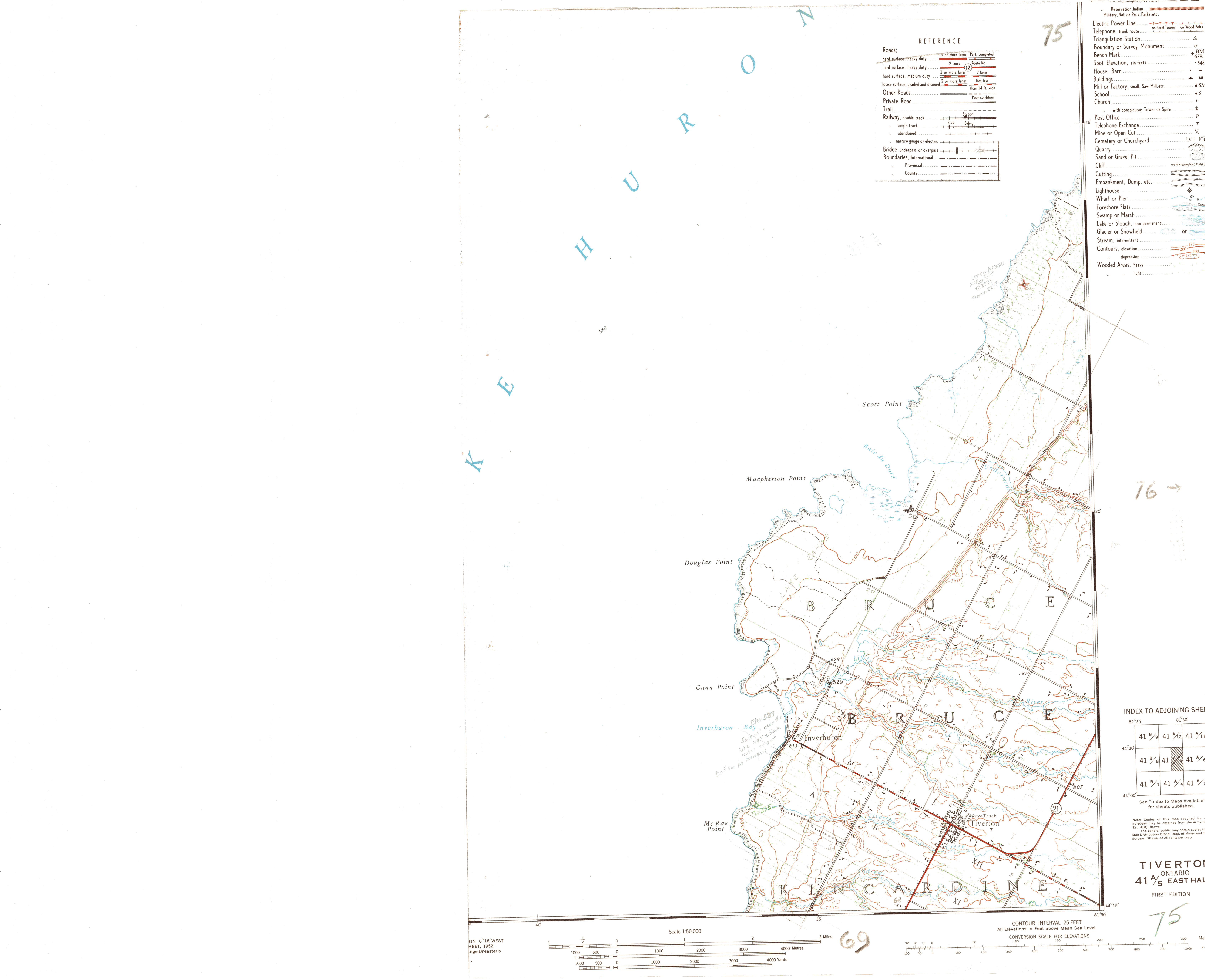
| Filename | Brittain_MAPFC_363_2018-08-10_1 |
| Map Title | Tiverton (Sheet 41 A/5 East Half) - Map 75 |
| Front/Back | Front |
| Blank | No |
| Physical Location | MAPFC |
| Cartographer | Department of National Defence Army Survey Establishment |
| Publisher | Department of National Defence |
| Date | 1950-01-01 |
| Copyright Holder | Government |
| Map Type | Resource |
| Continent | North America |
| Country | Canada |
| State | Ontario |
| County | |
| Township | |
| Municipality | |
| Lat Ne | 44.437003 |
| Long Ne | -81.500716 |
| Lat Sw | 44.248555 |
| Long Sw | -81.727287 |
| Map Scale Text | 1:50,000 |
| Map Scale Ratio | 1:50,000 |
| Quality Score | 2 |
| Documentation Score | 3 |
| Georeference Algorithm | |
| Well Points | Yes |
| Notes | A map of Tiverton with well locations, lots and concessions. |