| Filename | Brittain_MAPFC_309_2018-08-09_1 |
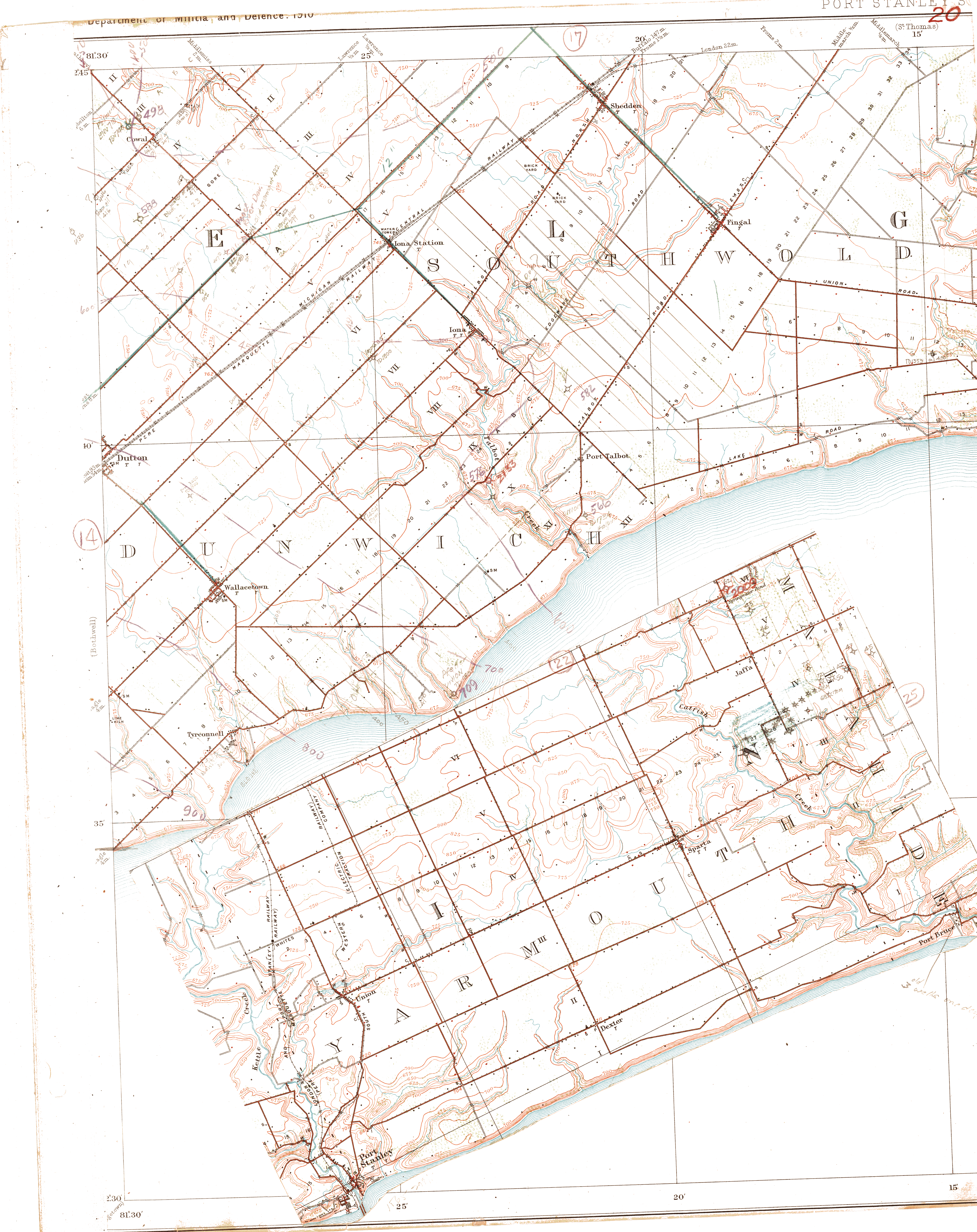
| Map Title | Elgin County, Southwold - Map 20 |
| Front/Back | Front |
| Blank | No |
| Physical Location | MAPFC |
| Cartographer | |
| Publisher | |
| Date | |
| Copyright Holder | |
| Map Type | Resource |
| Continent | North America |
| Country | Canada |
| State | Ontario |
| County | Elgin |
| Township | Southwold |
| Municipality | |
| Lat Ne | 42.748354 |
| Long Ne | -81.238884 |
| Lat Sw | 42.532363 |
| Long Sw | -81.510908 |
| Map Scale Text | |
| Map Scale Ratio | |
| Quality Score | 2 |
| Documentation Score | 3 |
| Georeference Algorithm | |
| Well Points | Yes |
| Notes | A map showing portions of Elgin - Southwold with well points and contours. |