|
Filename
|
Brittain_MAPFC_271_2018-08-08_1 |
|
Map Title |
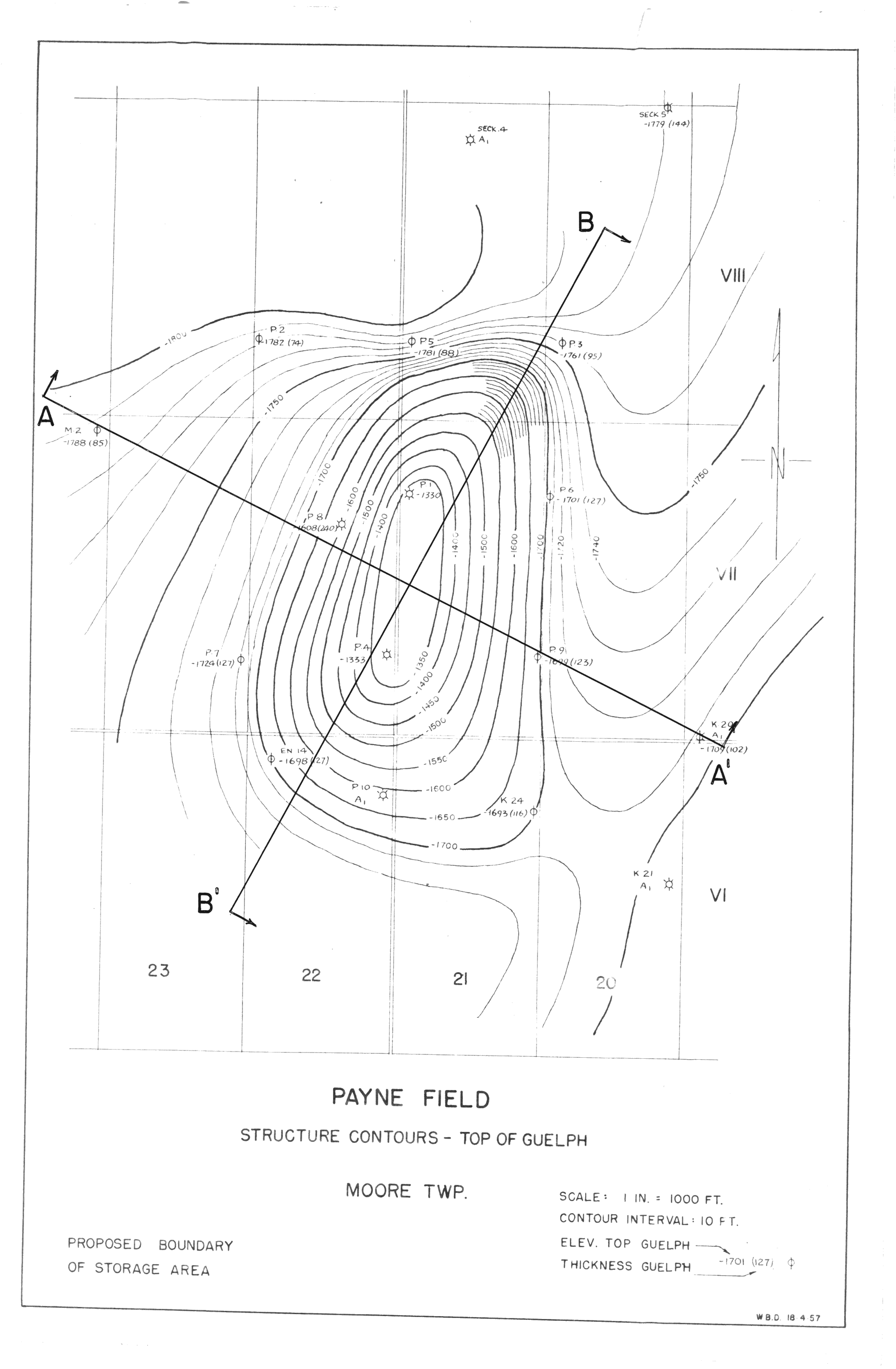
Payne Field Structure Contours - Top of Guelph |
|
Front/Back |
Front |
|
Blank
|
No |
|
Physical Location |
MAPFC |
|
Cartographer
|
|
|
Publisher
|
|
|
Date
|
|
|
Copyright Holder |
|
|
Map Type |
Resource |
|
Continent
|
North America |
|
Country
|
Canada |
|
State
|
Ontario |
|
County
|
|
|
Township
|
Moore |
|
Municipality
|
|
|
Lat Ne |
42.86275 |
|
Long Ne |
-82.375099 |
|
Lat Sw |
42.826629 |
|
Long Sw |
-82.410336 |
|
Map Scale Text |
1 inch: 1000 feet |
|
Map Scale Ratio |
1:12,000 |
|
Quality Score |
2 |
|
Documentation Score |
2 |
|
Georeference Algorithm |
|
|
Well Points |
Yes |
|
Notes
|
A map of showing structure contours of Payne Field indicating the proposed boundary of storage area. |