| Filename | Brittain_MAPFC_211_2018-08-07_1 |
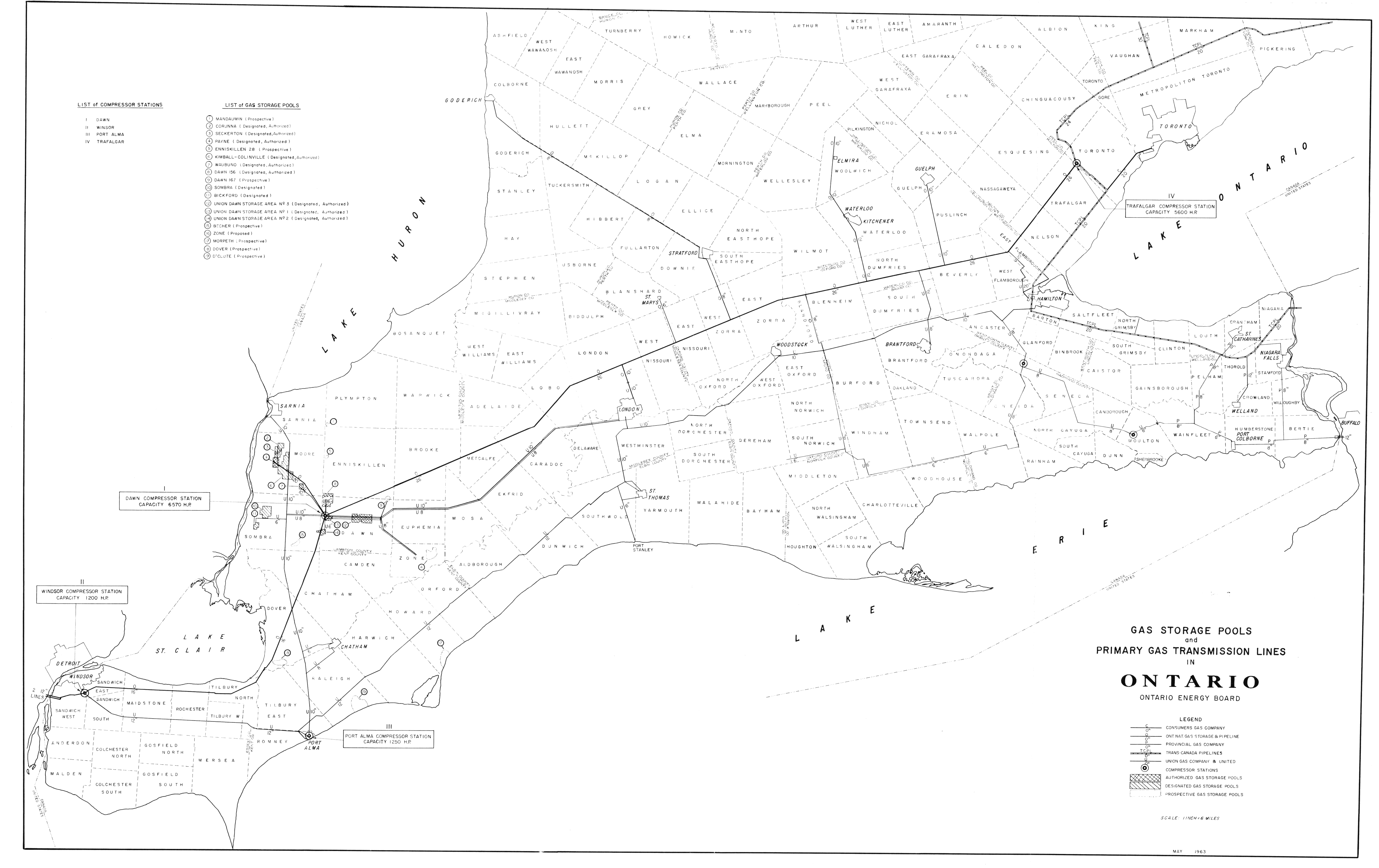
| Map Title | Gas Storage Pools and Primary Gas Transition Lines in Ontario |
| Front/Back | Front |
| Blank | No |
| Physical Location | MAPFC |
| Cartographer | Ontario Energy Board |
| Publisher | Ontario Energy Board |
| Date | 1963-01-01 |
| Copyright Holder | Ontario Energy Board |
| Map Type | Resource |
| Continent | North America |
| Country | Canada |
| State | Ontario |
| County | |
| Township | |
| Municipality | |
| Lat Ne | 43.956543 |
| Long Ne | -78.836424 |
| Lat Sw | 41.874084 |
| Long Sw | -83.236271 |
| Map Scale Text | 1 inch: 6 miles |
| Map Scale Ratio | 1:380,160 |
| Quality Score | 2 |
| Documentation Score | 1 |
| Georeference Algorithm | |
| Well Points | No |
| Notes | A map showing gas storage pools and primary gas transitions across Ontario. |